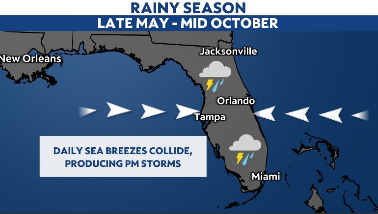
We are getting into the rainy season. Moisture, heating and the sea breeze all cause our summer storms.
As we get later in June, the water temperature warms up and this changes the timing of when the sea breeze forms and its general location.
Not every day is exactly the same, but when we are locked in to a typical summer pattern, the outcome is often quite similar.
Take a normal weather pattern during our summer months. We usually have an east or southeast wind, temperatures rise, showers form and then thunderstorms get enhanced along the west coast sea breeze front very late in the day.
What causes the sea breeze?
The sea breeze forms because the land and the water heat up at different rates. In general, land heats up faster than water. This differential heating causes a pressure difference.
Lower pressure forms over the warmer land, while higher pressure forms over the water. The pressure differences are subtle, but noticeable enough that the air flows from high to low pressure, resulting in a sea breeze.
With the water temperatures approaching the upper 80s to low 90s by late June, the sea breeze formation occurs later in the day than when the water temperatures are cooler. This, combined with a common east or southeast wind, causes the sea breeze front to remain near the coast.
As showers and storms form on a typical summer afternoon, they work their way back toward the coast until they run into the sea breeze front.
Think of that sea breeze front like a cold front. It divides two air masses: a warm, humid and unstable air mass over land and a more stable air mass over the water.
That boundary becomes an extra mechanism in the atmosphere to cause the air to rise more rapidly. This is what generates stronger thunderstorms late in the day.
Since the water temperatures are getting warmer, those stronger, more intense thunderstorms tend to form later in the day and nearer to the coast.
Places like coastal Manatee and Pinellas Counties typically get into the rainy season a few weeks later than places like Polk County.
The sea breeze front is the reason.