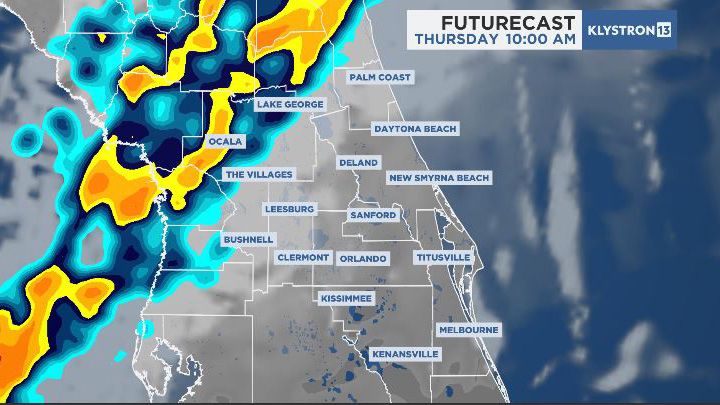
A system sparking a severe weather outbreak over parts of the southeastern U.S. today will sweep a line of strong to possibly severe storms into central Florida Thursday.
This line moves into Marion County between 10 a.m. and 11 a.m. Thursday.
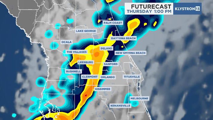
Movement to the southeast will bring it into the I-4 corridor sometime between 1 p.m. and 2 p.m.
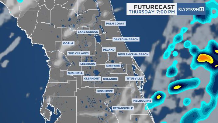
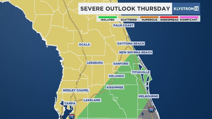
The line begins to fall apart as it moves southeast, and any rainfall wraps up before 7 p.m. area-wide. Although the threat of severe storms is low, we may see a few wind gusts over 50 mph and may spin up an isolated tornado along the line.
We’ll pick up some beneficial rain but keep totals under an inch, and there is no concern for widespread flooding. Be sure to have the Spectrum News app and turn on notifications. We’ll alert you to any severe weather, then tune in to live coverage on air.
Behind the front, we clear out quickly Thursday night, with gorgeous weather on tap Friday through the weekend.
Our team of meteorologists dives deep into the science of weather and breaks down timely weather data and information. To view more weather and climate stories, check out our weather blogs section.