Hurricanes are hazardous, especially when they impact land directly. One that undergoes rapid intensification prior to landfall raises even more of a threat, since it can bring a whole new level of impacts and public safety concerns.
The term rapid intensification should ring a bell.
Even though hurricane season is winding down from an active August and September, meteorologists covering the tropics mentioned ‘rapid intensification’ several times this year.
But the phrase doesn’t get thrown around loosely. Specific parameters need to be met (or at least are in the forecast) for a tropical cyclone to undergo rapid intensification.
Is rapid intensification trending?
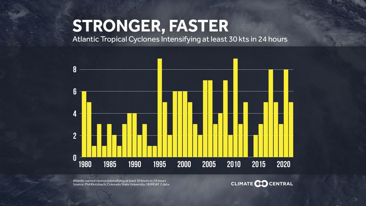
While the 2023 season is not over yet, all three major hurricanes that formed this year intensified rapidly. Over the last decade, the only year to see no storms undergo rapid intensification in the Atlantic was in 2013.
Since then, at least one tropical cyclone intensified rapidly during the season, with the 2017 and 2020 season seeing the most. Eight storms underwent rapid intensification both years.
A recent report from Climate Central noted that between 1980 and 2021, the Atlantic basin counted approximately 170 landfalling tropical cyclones that underwent rapid intensification.
Roughly 70% of the 170 tropical cyclones that intensified rapidly happened between 1995 and 2021.
(Climate Central)
The same report also verified that around 80% of major hurricanes that formed rapidly intensified.
Challenges with forecasting and communicating rapid intensification
While the number of tropical cyclones undergoing rapid intensification is climbing, researchers are still seeking answers behind the mechanisms that make it more likely for some storms and not others.
In general, all the ingredients that support tropical development must be there, including warm waters, a good amount of atmospheric moisture and low vertical wind shear. But to what extent remains ambiguous and presents challenges in regard to forecasting rapid intensification.
Despite that, advancements in computer models, such as NOAA’s new Hurricane Analysis and Forecast System (HAFS), shows promising improvements in detecting rapid intensification.
Before launching in June 2023, HAFS outshined the other NOAA hurricane models when it accurately predicted that Hurricane Ian would undergo rapid intensification before making landfall along the Florida Gulf coast in September 2022.
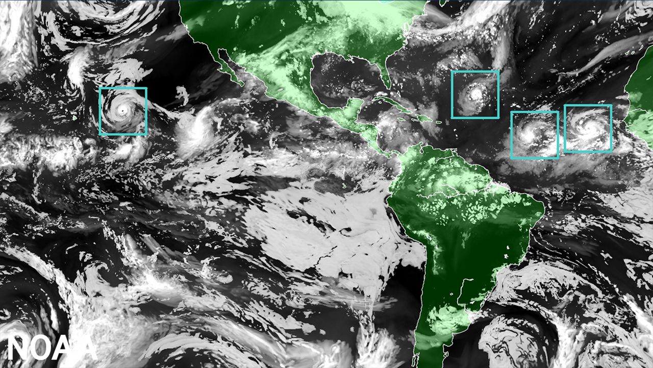
Global map showcasing the HAFS model. The image depicts the model prime “moving nests” feature, which are the boxes surrounding each tropical system. (NOAA)
Still, there’s another hurdle meteorologist must clear- effectively relaying forecast information to the public.
Chief Meteorologist Bryan Karrick from Spectrum News 13 in Orlando explains that, “As meteorologists, we need to convey the potential for rapid intensification without scaring the public, but to make sure those in the path have time to evacuate if necessary.”
A tropical cyclone that undergoes rapid intensification prior to landfall not only increases the likelihood of costly damages but also puts more of the community at risk of facing life-threatening impacts. Less time to communicate the potential of rapid intensification limits the public’s capability to prepare accordingly.
With that, Karrick reminds us that, “We also need bring attention to those outside of the cone of concern that impacts of a hurricane can extend well outside the cone, so people should always be ready with a storm nearby.”
Our team of meteorologists dives deep into the science of weather and breaks down timely weather data and information. To view more weather and climate stories, check out our weather blogs section.