A developing storm system will spell trouble for travel in the days leading into the Thanksgiving holiday.
From heavy rain and gusty winds to winter weather, this multi-hazardous storm will especially impact the eastern half of the country, causing many travel delays and cancellations through midweek.
A storm system developing in the Central U.S. will intensify as it heads east over the next few days, and will likely interrupt travel plans for many leading into the Thanksgiving holiday.
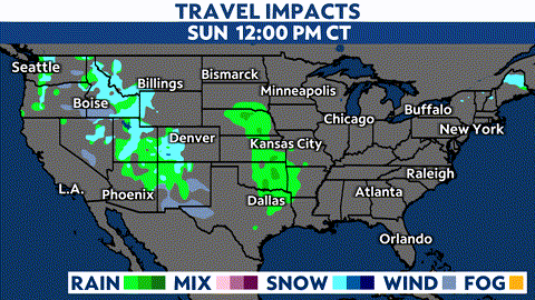
In its early stages, this system will bring mainly rain and thunderstorms across parts of Texas, the Plains and the Mississippi River Valley Sunday night into Monday.
As it intensifies, this storm will bring periods of heavy rain and gusty winds in across the Ohio Valley on Tuesday before heading into the Northeast.
Even though the core of the storm will pass well north, a cold front extending from its center will still bring widespread rain and thunderstorms across the Southeast as well on Tuesday into Wednesday.
Severe weather threat
Energy from this system will pull up plenty of moisture from the Gulf of Mexico. This, combined with atmospheric instability, will trigger the potential for powerful storms.
While some embedded storms could bring locally heavy rainfall across the Plains and into the Midwest, the threat for severe weather will stay confined to parts of eastern Texas and the Deep South on Monday, where the Storm Prediction Center (SPC) issued a marginal to an enhanced risk (level 1-3 of 5).
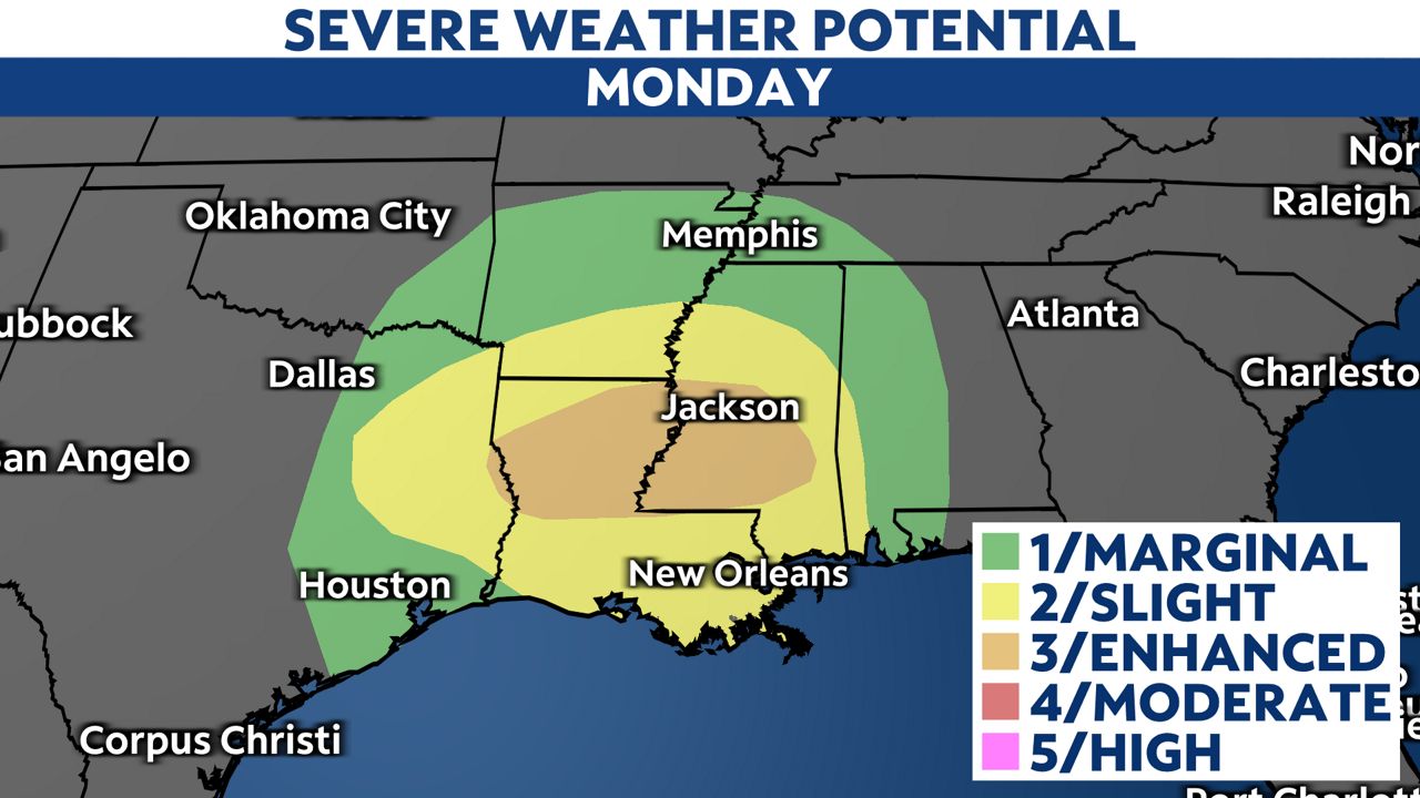
All modes of severe weather are possible, with parts of the Lower Mississippi River Valley facing the greatest threat.
Along with the potential for damaging winds, heavy downpours and large hail, several tornadoes are also expected- some which could be strong.
Winter weather
Sections of the Upper Midwest could see some snow showers on the backend of this system as it moves across the Great Lakes on Tuesday.
Yet, parts of the Northeast will likely encounter bigger winter weather impacts from it through midweek. Snow, sleet and freezing rain will create additional hazards for travelers.
Even though much of the Mid-Atlantic looks to see wet and windy conditions from this system, heavy wet snow and a wintry mix will make for dangerous traveling conditions across parts of central and eastern New York and northern New England.
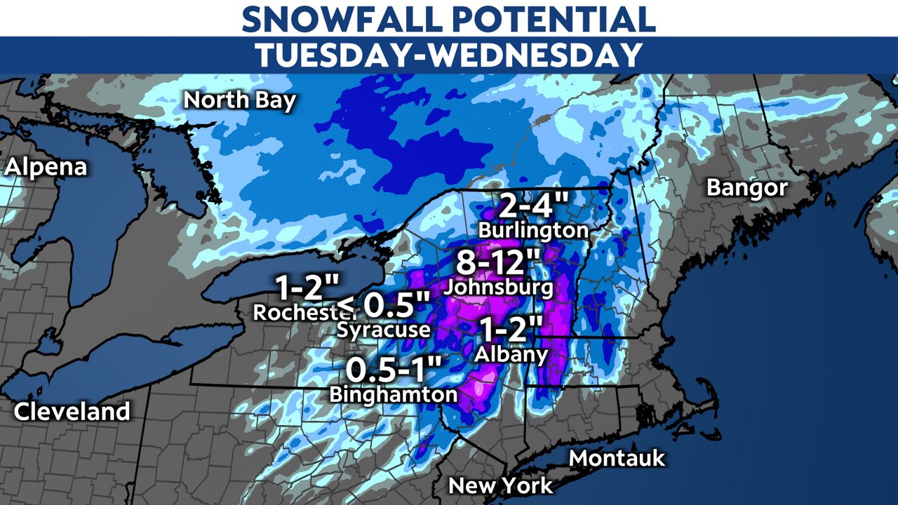
Parts of Upstate New York and interior New England will see the highest accumulations, where localized snowfall totals could add up to a foot or more by the time the storm exits the region.
Amounts aside, heavy snowfall and gusty winds could significantly reduce visibility and make roads rather slippery. Drivers who do not need to be out should stay off the roads during the height of the storm.
Be prepared
Depending on where you are headed and when, be prepared to encounter travel delays in the coming days. Make sure to keep a close eye on the forecast at your current location and desired destination, and be sure to check flight status before heading to the airport.
For those traveling by car, plan your trip according. Remember to keep these safety tips in mind while driving in the rain.
Those traveling through areas where winter weather is expected, stay off the roads during the height of the storm and avoid dangerous driving conditions by leaving beforehand.
Remembered to check here for the latest updates and information in the days ahead.
Our team of meteorologists dives deep into the science of weather and breaks down timely weather data and information. To view more weather and climate stories, check out our weather blogs section.