Hurricane season is here, and we’ll show the infamous forecast cone for storms throughout the season.
But, do you know what each of the tropical weather icons represents on a forecast cone?
It can get a little confusing. Here is a simple breakdown of what each one represents.
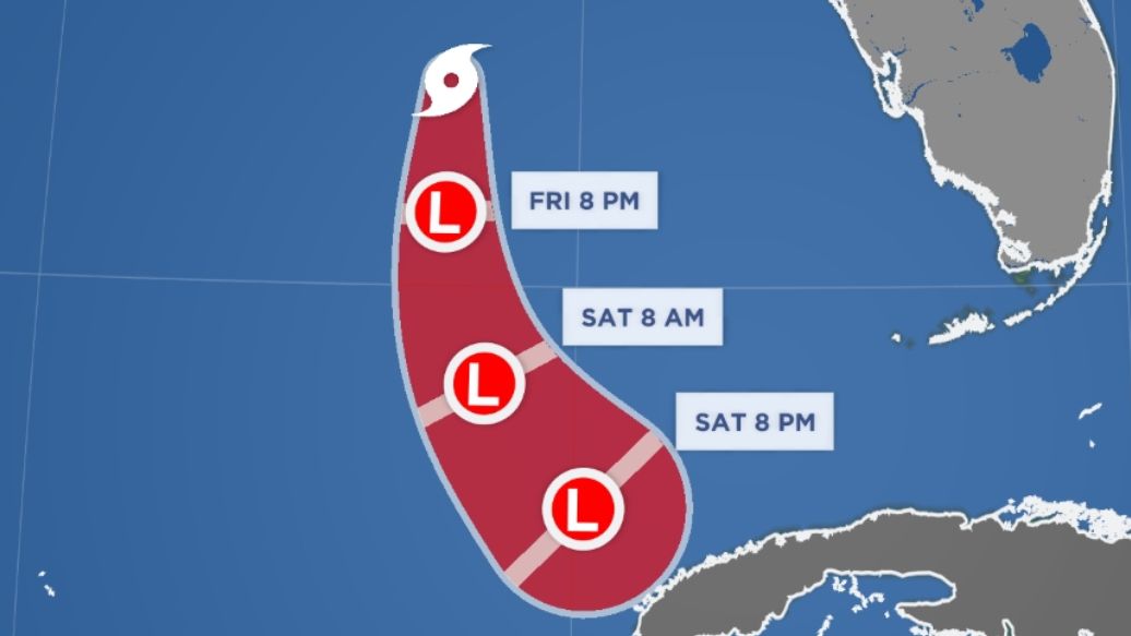
Below is an example from Tropical Storm Arlene that formed earlier in 2023 in the Gulf of Mexico.
Tropical depression
The enclosed circle with the L generally represents a tropical depression.
A tropical depression occurs when there is a closed center of low pressure that becomes organized.
Generally, there are thunderstorms around the center, but the storm only contains winds of 38 mph or less.
Tropical storm
The tropical storm icon resembles that used for a hurricane.
So what’s the difference?
The tropical storm icon usually has an open circle in the middle.
A system becomes a tropical storm when the center has become better-defined, and winds have strengthened into the 39-73 mph range.
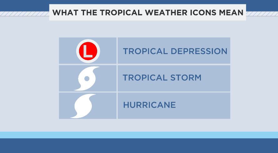
Hurricanes
The hurricane icon is the one you’re likely most familiar with when looking at a tropical weather forecast.
The hurricane icon is like the tropical storm icon, but as mentioned earlier, it does not have the open circle.
A storm becomes a hurricane when winds hit 74 mph or stronger.
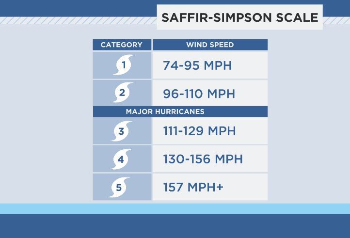
Sometimes the hurricane icon will appear with a number on it.
This number shows one of the five categories that hurricane strength is based on, which is known as the Saffir-Simpson Scale.
Category 3, 4 and 5 hurricanes are major hurricanes. We consider them major hurricanes because devastating to catastrophic damage can occur with each of these storms.
Not to say that a Category 1 or Category 2 hurricane can’t produce extensive damage, but there is a greater likelihood with the strongest storms.
A Category 3 hurricane starts with winds of 111 mph, and Category 5 has winds of 157 mph or greater.
Our team of meteorologists dives deep into the science of weather and breaks down timely weather data and information. To view more weather and climate stories, check out our weather blogs section.