High pressure systems typically bring blue skies, sunshine and a light breeze- all the most desired conditions. Its positive connotations make it more favorable than its counterpart, low pressure.
But sometimes strong areas of high pressure can jam up or block our weather pattern, ultimately bringing undesired impacts.
Despite the rather mild and pleasant weather it is associated with, high pressure systems can come with consequences.
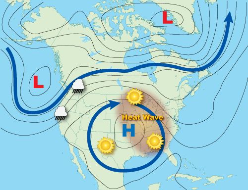
As an area of high pressure continues to grow and strengthen, it can become a block, preventing fronts and other weather systems from flowing through the region it reigns over.
Graphic showing an example of a blocking high setup. (NOAA)
Like other blocking patterns, this could lead to catastrophic effects.
Most commonly, these stubborn areas of high pressure generate what’s called a heat dome, bringing dangerous heat and extreme drought conditions for places living under it.

A heat dome brought days of triple-digit temperatures to the state of Texas in the summer 2023. In the photo above, a woman fans herself to keep cool during a Houston Astros game on June 17. (AP Photo/David J. Phillip)
Sometimes, however, a blocking high could also prevent a low pressure system moving around it. As a result, the low becomes stuck over an area for an extended time, producing heavy rainfall and flooding.
Blocking highs and hurricanes
Back in Aug. 2017, Hurricane Harvey made landfall near Port Aransas, Texas, as a Category 4 hurricane. Despite weakening over land, a large and prominent area of high pressure centered to the north and west was strong enough to stop Harvey right in its track- literately.
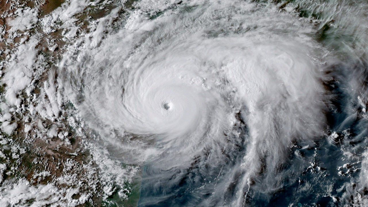
Satellite image of Harvey hovering over the Texas coastline in August 2017. (NOAA)
If it stalled further inland, Harvey most likely would have fizzled out. However, the storm was parked itself in an ideal spot closer to the coast.
Because of this, it could still keep itself fueled from the warm waters of the Gulf of Mexico, dumping rounds of heavy rain across a good portion of eastern Texas for days.
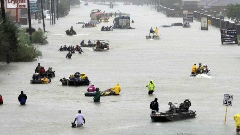
Rescue boats set out on a flooded street to save Harvey victims in Houston on August 28, 2017. (AP Photo/David J. Phillip)
Seeing a about a year’s worth of rain in a matter of days, the city of Houston was devastated by massive flooding for days. Not only did flooding contribute to the $125 billion in damages, making it the second costliest hurricane in the U.S., but it also claimed over 100 lives as well.
High pressure to the northwest lost some of its intensity, which allowed Harvey to drift away from the region.
Our team of meteorologists dives deep into the science of weather and breaks down timely weather data and information. To view more weather and climate stories, check out our weather blogs section.