A potent cold front is eyeing Central Florida, and it will bring the risk for strong to severe storms Thursday.
Rain and storms will move in from the west by mid-morning, and the risk for stronger storms will last into the early evening.
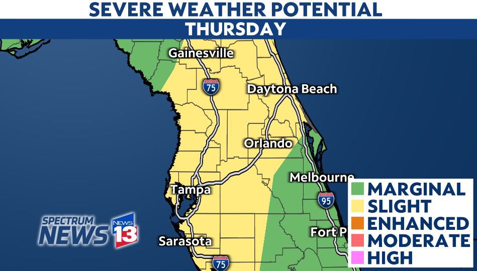
Areas along Interstate 4 around Orlando and toward the northwest have a higher risk for scattered severe storms. This is where a slight risk for severe weather has been placed across the area on Thursday.
Meanwhile, an isolated severe storm or two will be possible in Osceola and Brevard counties, where there is a marginal risk for severe weather.
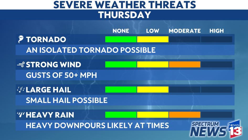
The primary hazards with any stronger storms will be the potential for gusty, damaging winds, frequent lightning and heavy downpours.
An isolated tornado or two will be possible across the region.
Stay with Spectrum News 13 and Klystron 13 for the latest timing on Thursday’s storms and any severe weather warnings that could be issued for Central Florida.
You can also check the settings in your Spectrum News app to make sure weather alerts are on.