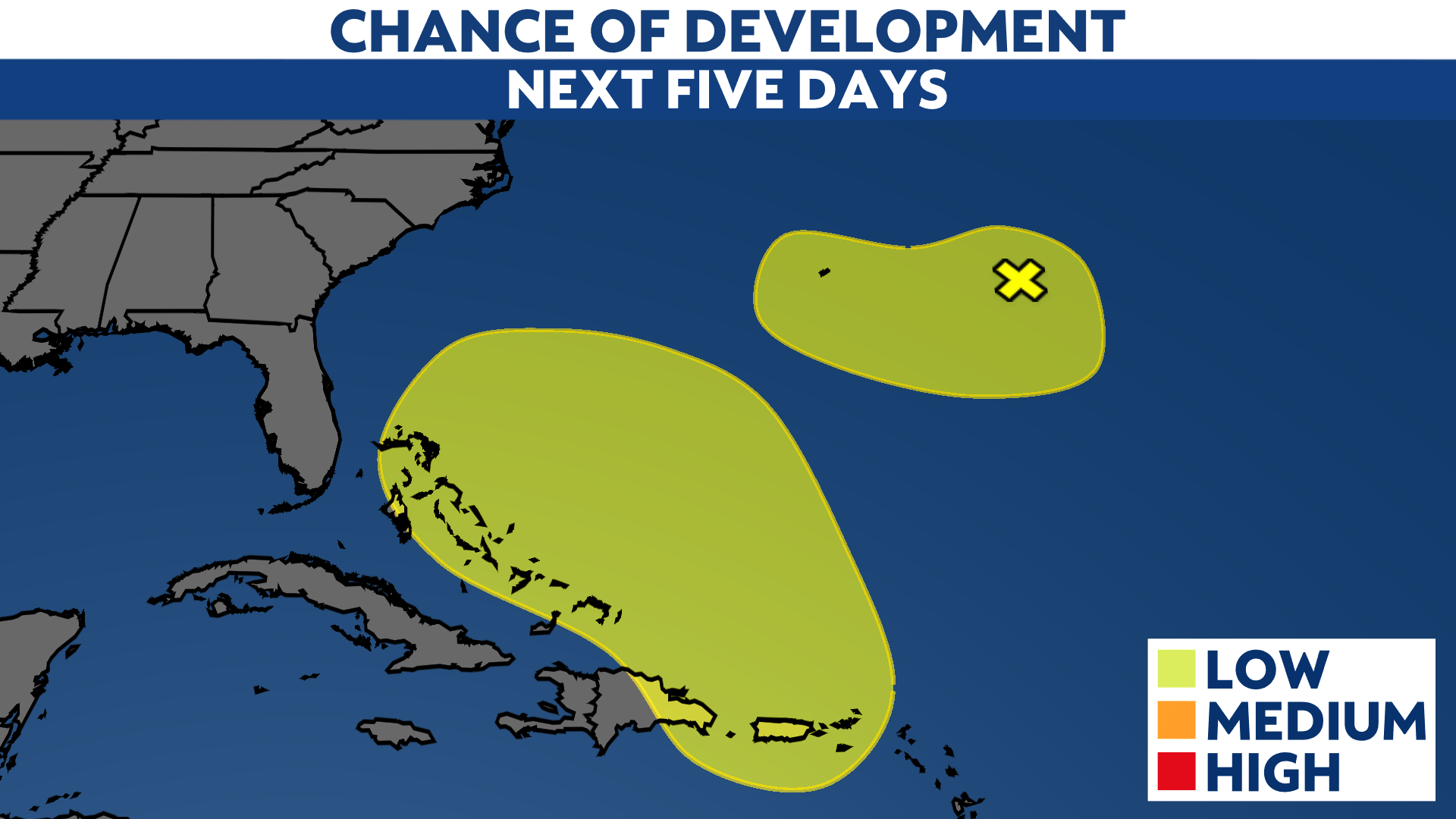
A non-tropical low-pressure system has a low chance of developing into a weak subtropical or tropical storm near the Bahamas early next week.
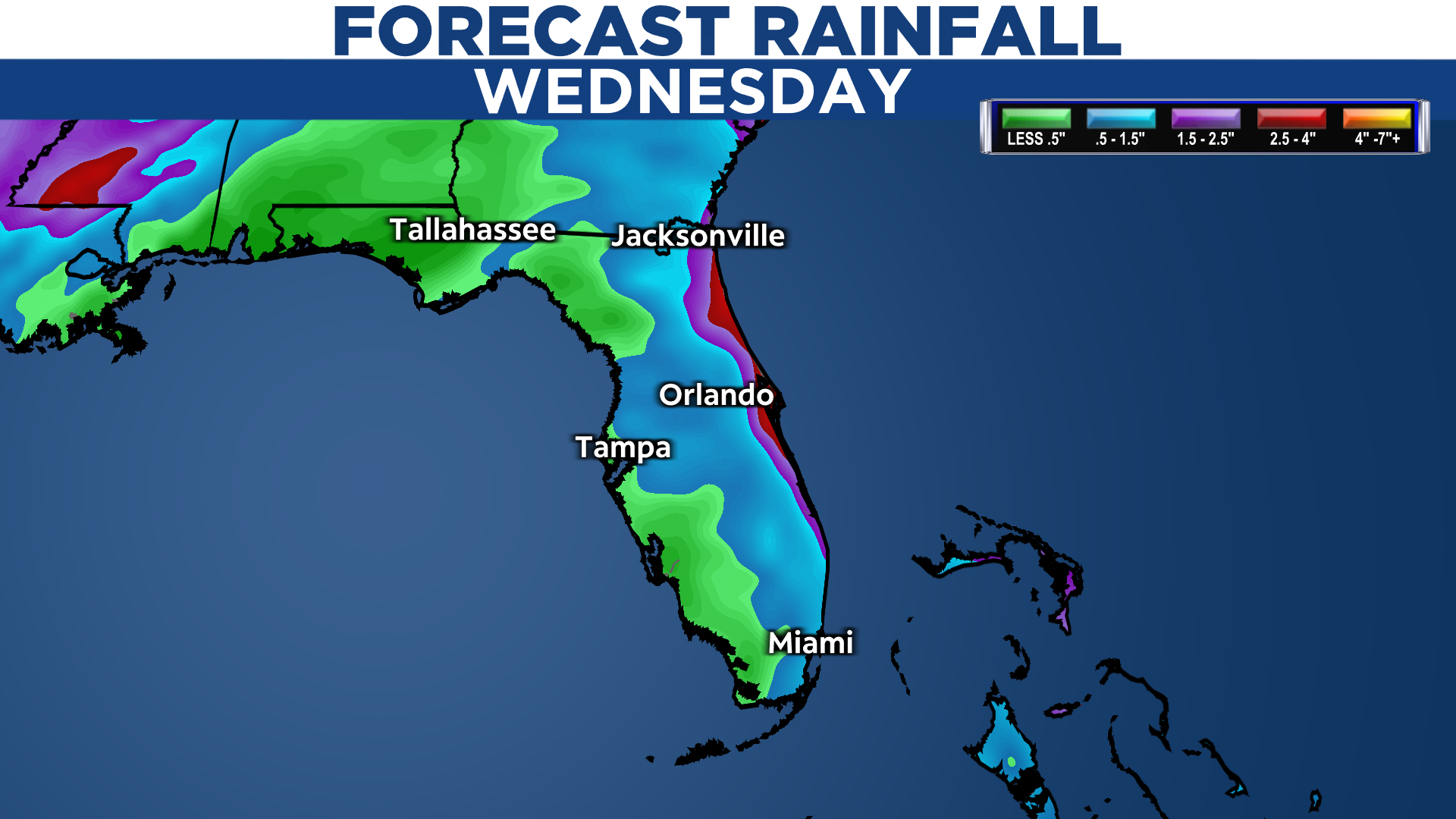
Regardless of development, we will likely see rain chances increase across Florida on Tuesday and Wednesday. Even if this system can become a subtropical or tropical storm, winds will likely not be the main issue.
Most of the weather models keep this system as a broad low-pressure system as it nears Florida late Tuesday and into Wednesday.

At this point, it’s hard to say how far west this could go as its future track depends on the timing of a frontal system coming in from the northwest next week. This frontal system will eventually direct this area of low pressure to the northeast.
Most of the computer forecast models indicate that the sytem will lose steam as it moves west, bringing more rain to the east coast of Florida compared to the west coast. That’s where a few inches of rain could fall.
This system is still five days out from affecting Florida, so expect some tweaks in the forecast over the coming days.
Overall, it appears that this system will most likely stay non-tropical. This is why the National Hurricane Center is just giving it a low chance of tropical development for now.
Stay updated for any possible changes over the next few days.