Better weather models should lead better forecasts and that’s the projected outcome for NOAA’s new hurricane forecast model, the Hurricane Analysis and Forecast System (HAFS).
The demand for better forecast models is a perpetual goal, especially for forecasting hurricanes.
A record-breaking number of named storms may not be in the cards for the 2023 Atlantic Hurricane Season. However, access to a new and improved forecast model could mean the storms that form will be better forecast compared to past seasons.
The release of NOAA’s new hurricane forecast model, HAFs, strives to set a higher standard in forecasting the track and intensity of the storm as well as reducing forecast error in the years (or seasons) to come.
The HAFS model breakdown
Following a three-year experimental trial, HAFS officially launched in late June and will continue to operate throughout the season in tandem with the other models that are typically used. Although it is expected to replace these preexisting models in the years to come.
The new-generation model features five major upgrades that sets it apart from the existing hurricane models, providing higher-resolution over both land areas and the ocean. Such upgrades include 3-D ocean coupling, multiple advanced assimilation techniques and high-resolution physics.
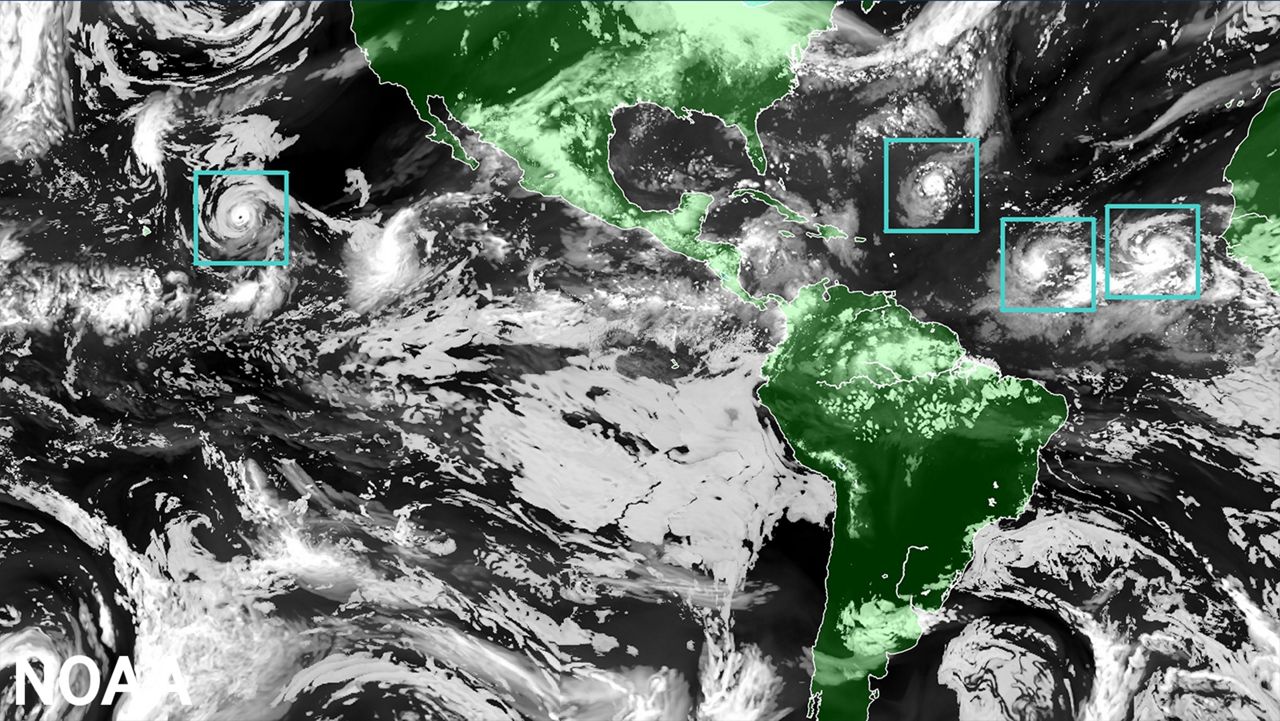
The primary advancement is the high-resolution moving nest. This feature alone gives the capability to zoom in or out over parts of the tropical cyclone (at a resolution of 1.2 miles), which can help determine wind and rain intensity.
Global map showcasing the HAFS model. The image depicts the model prime “moving nests” feature, which are the boxes surrounding each tropical system. (NOAA)
The ability to predict the storm’s track accurately and timing remains the utmost priority- nailing this in advance can help determine what areas will be affected the most and will allow communities the time to prepare accordingly.
Compared to the other hurricane forecast model, HAFS shown a 10 to 15% increase in forecast track accuracy in its trial era alone. This percentage is only projected to grow larger with time, since the model will undergo additional upgrades in the future.
Other factors, including the storm’s size and intensity, are also just as important to consider. Both can help gauge the magnitude of the impacts.
HAFS is comparable to the other hurricane forecast models when it comes down to intensity. Although it shines brighter than the rest, with foreseeing whether a storm will undergo rapid intensification.
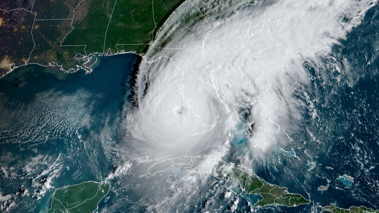
Satellite image of Hurricane Ian just hours before making landfall near Cayo Costa, Florida, on September 28, 2022. (NOAA)
In September 2022, the experimental HAFS was the only one to forecast Hurricane Ian’s secondary rapid intensification upon reaching the Florida Gulf Coast.
The more, the merrier
Compared to other models, HAFS was built via collaboration. Several organizations came together to create it, including NOAA’s National Weather Service Environmental Modeling Center, Atlantic Oceanographic and Meteorological Laboratory and NOAA’s Cooperative Institute for Marine and Atmospheric Studies.
Implementing the specific data and observations from each entity/corporation computes the model’s enhanced output. The additional details and data provided essentially yield a more precise forecast model.
Because of all its bells and whistles, HAFS needs to run on a supercomputer. With this, it is the first major model to use NOAA’s new Weather and Climate Operational Supercomputing System 2 (WCOSS2), which was launched in 2022.
Forecasting the future of HAFS
Despite all the current advancements, NOAA is always on the hunt for additional improvements.
Within the next two to three years, it seeks to launch a basin-scale HAFS, which will help predict the behavior and potential affects tropical cyclones could generate post-landfall. The aim of this is to provide meteorologist with better products geared toward forecasting wind, rainfall and even tornado threats.
Hoping to improve risk communication in the future, NOAA’s Hurricane Forecast Improvement Plan is also investigating in an ensemble model of the HAFS.
While other improvements to HAFS are expected over the next few seasons, cutting hurricane forecast error in half by the year 2027 remains one of the agency’s biggest goal.
Until then, HAFS will be put to the test over the next several weeks as we approach the peak of hurricane season.
Our team of meteorologists dives deep into the science of weather and breaks down timely weather data and information. To view more weather and climate stories, check out our weather blogs section.