National Hurricane Center
Both tropical disturbances are making their way closer to the Caribbean throughout the week.
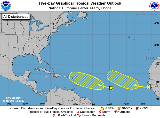
The National Hurricane Center is keeping an eye on two tropical waves in the Atlantic that have potential to transform into hurricanes.
Both disturbances are being monitored to determine their likelihood of tropical storm development and expected pathway throughout the week.
The NHC has reported low formation possibility over the next 48 hours , but has predicted a 20% chance of formation over the next five days.
The first wave, located off the west coast of Africa, is producing an area of disorganized thunderstorms and showers, according to the NHC. As it continues west across the Atlantic, further development seems unlikely.
The second wave, located between the Windward Islands and the west coast of Africa, is following a similar path. This wave is produce large thunderstorms and has potential to develop slowly over the coming days, according to the NHC.
Florida’s 2022 hurricane season has seemed unusually slow, especially considering that we felt the largely devastating effects of Hurricane Irma only five years ago.
Meteorologists have considered Sept. 10 to typically be the peak of hurricane season, as this is when the most potential activity develops in the Atlantic.
Even as this already-quiet hurricane season starts to simmer down, it’s important to keep a close eye on any new developments and remain prepared in case of any oncoming weather.
You can stay updated on the path and size of these two tropical disturbances through the National Hurricane Center website.