A very active March has led to beneficial rainfall, putting a big dent in the drought and reducing the risk for brushfires.
After a very dry February, an active weather pattern developed across Florida. The pattern resulted in many storm systems marching through the area, bringing rounds of rain and storms in March.
While the rainfall and storms resulted in severe weather at times, it also brought beneficial rain to the area.
As of Friday, in March, the Orlando International Airport has received a stunning 5.71 inches of rain. This is 3.40 inches above the average for the month.
In all of February, Orlando only received 0.71 inches of rain.
This rainfall has helped green foliage once again and also put a significant dent in the developing drought across the area.
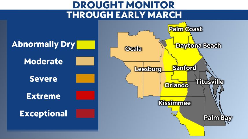
On March 10, the weekly Drought Monitor from the National Drought Mitigation Center showed most of the central Florida had been declared abnormally dry, with moderate drought conditions rapidly expanding in western areas.
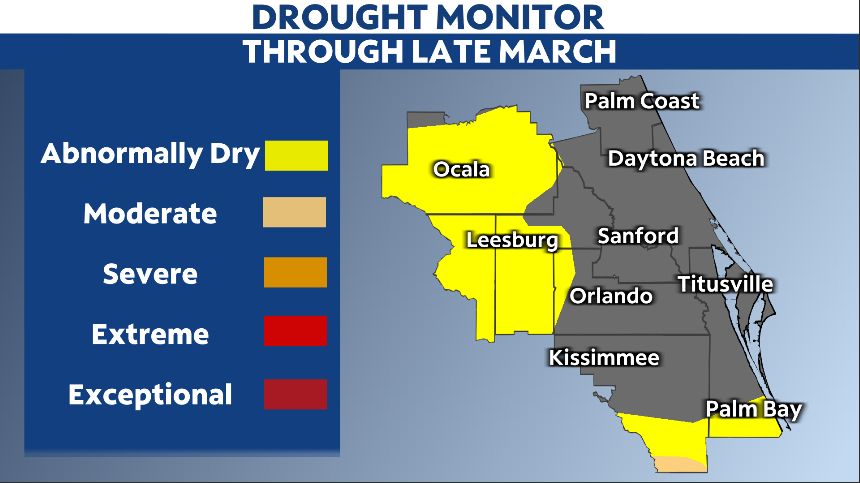
Just two weeks later, the moderate drought has pushed out of the region, with only abnormally dry conditions remaining in areas south and west of Orlando.
This significant reduction in drought conditions is vital, as it could help reduce the severity of drought conditions later this spring.
The rainfall has also helped reduce the brushfire threat across Florida.
Brushfire conditions were increasing across much of the state in February and early March. The panhandle has already seen a significant brushfire in the Panama City area.
With the recent rainfall, it has greatly reduced the threat for brushfires across central Florida.
It looks like more rainfall could be on the way in the next couple of weeks.
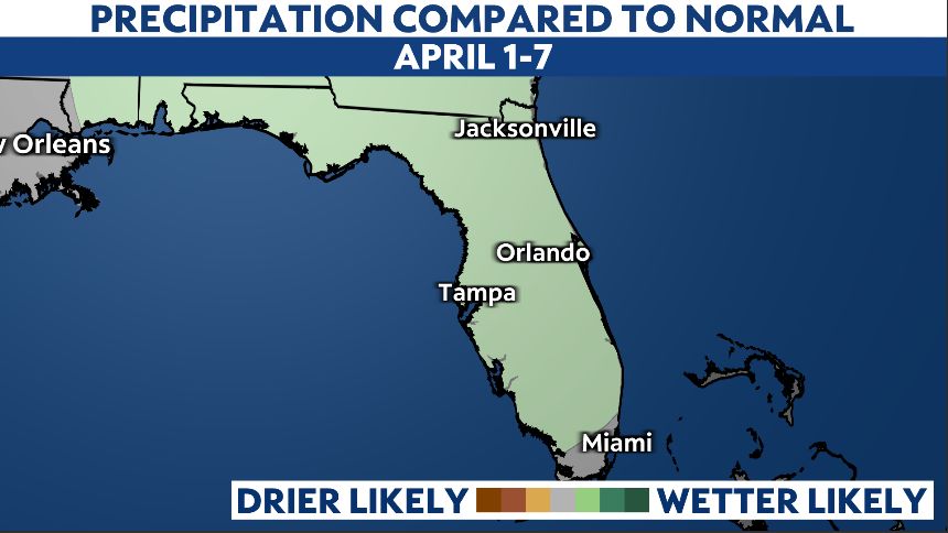
The latest 8-14 day precipitation outlook from the Climate Prediction Center shows above average rainfall for the first week of April across the entire state.
Unfortunately, the rounds of bountiful rainfall may come to a close later in April.
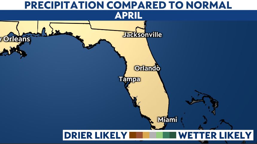
The long-range 30-day precipitation outlook for the entire month of April shows below average precipitation across all of Florida.
If the rainfall stops, once again, the threat of the drought building back into the region will increase.
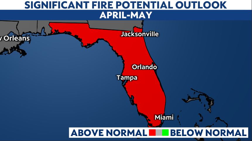
And while the rain has reduced the threat for brushfires in March, that may not hold for the peak of brushfire season in mid-to-late spring.
The Significant Fire Potential Outlook from the National Interagency Fire Center shows the entire state still has an above-average risk for brushfire in both April and May.
While the rainfall this month has been great news, we’ll need more rain to keep the drought at bay and reduce the threat of brushfire for the rest of the spring.