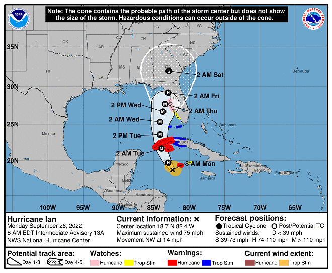
It seems increasingly likely that a major hurricane will land in Central Florida this week.
The National Hurricane Center’s latest track for Hurricane Ian shows the eye passing over the Tampa Bay area as it heads Northeast from its current position in the South Caribbean.
Western Cuba is expected to begin feeling the effects of Ian later today, and Ian is expected to impact the island as a major hurricane, lose strength over land and then grow in intensity over the warm waters of the Eastern Gulf of Mexico before impacting Florida.
“Considerable flooding impacts are possible later in the week in West Central Florida,” the NHC shared. “Additional flash and urban flooding, and flooding on rivers across the Florida peninsula and parts of the Southeast cannot be ruled out for later this week.”
The NHC noted that life-threatening storm surge and hurricane force winds are possible in an area ranging from Tampa Bay to the Panhandle later this week. Hurricane and tropical storm watches are in effect.