Ever heard of El Niño? It’s like nature’s weather switch-up button. When El Niño develops, it’s not just a subtle change. It’s a significant change for weather across the world.
As we head into the upcoming fall and winter, here’s how El Niño could affect you.
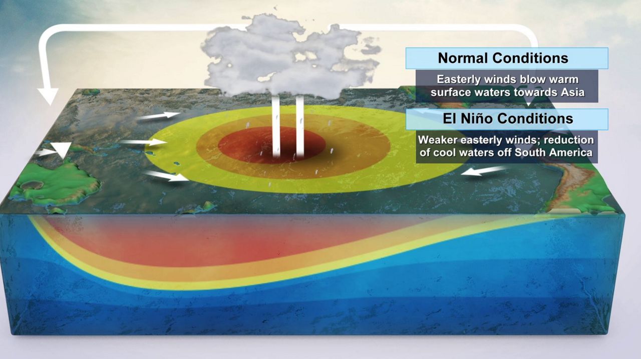
Understanding El Niño
El Niño is part of the broader El Niño-Southern Oscillation (ENSO) climate pattern. It refers to the periodic warming of sea surface temperatures in the central and eastern equatorial Pacific Ocean. This warming disrupts normal weather patterns, leading to a cascade of effects worldwide.
El Niño develops from warmer oceanic waters located off the west coast of Central and South America.
El Niño events typically develop every few years. The process begins when the trade winds, which usually blow from east to west across the Pacific, weaken or reverse direction. This allows warm surface waters to move eastward, accumulating near the coast of South America.
When sea surface temperatures in the central and eastern Pacific rise over 0.5 degrees Celsius above normal for an extended period, an El Niño event is declared.
Impacts to the Southeast U.S.
El Niño winters can bring a range of weather anomalies to the Southeastern U.S., including Florida. Here are some of the key impacts:
1. Increased rainfall
El Niño tends to bring wetter conditions to the Southeast. Florida, in particular, experiences higher-than-average rainfall during El Niño winters. This can lead to localized flooding, especially in low-lying areas and regions prone to heavy downpours.
According to the National Weather Service in Tallahassee, Central Florida averages between 8 to 10 inches of rainfall during a typical winter. But during El Niño winters, that rainfall total rises to between 10 and 13 inches.
One El Niño winter season even brought 18 inches of rainfall during the winter. Central Florida leads the entire state for above average rainfall during El Niño winters, with some locations averaging as much as five inches above normal.
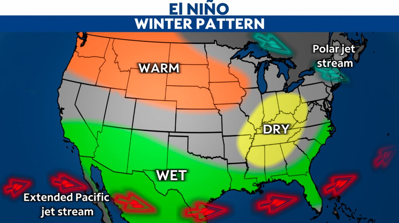
A typical El Niño weather pattern brings a colder but wetter winter season to the southeast.
Added rainfall is a nice benefit during the winter as it can help mitigate our wildfire danger, which often peaks during the winter months. But it can create waterlogged grounds, which can cause a concern as we head toward the rainy season.
If grounds are already waterlogged heading into the rainy season, flooding becomes a bigger threat in those following months.
2. Cooler temperatures
While the Southeast is known for its mild winters, El Niño can introduce cooler temperatures. Cold fronts can be more frequent, bringing occasional frost or freezes, which may affect agriculture and horticulture.
This is because during El Niño winters, the jet stream – which is an elongated area of fast-moving winds across the country – becomes more zonal. This provides a more west to east flow, producing less Arctic air outbreaks across the northern tier of the country.
But because that limits Arctic outbreaks, it means the subtropical jet stream along the Gulf Coast can linger through the winter months. Typically, this will sag south toward Central America during this time of the year.
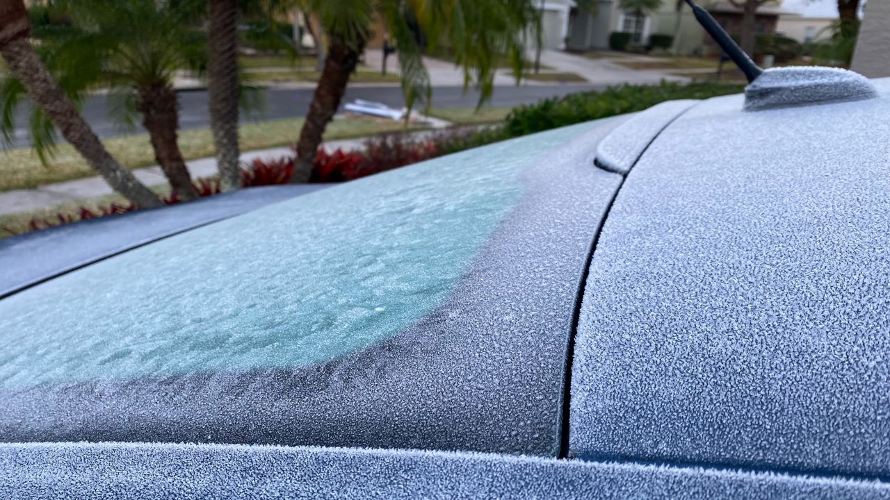
Frost forms on a car as Central Florida is dealt a cold arctic blast. (Photo by Jess Miller)
As the subtropical jet lingers around Florida and the southeast, it can produce more areas of low pressure, which creates more clouds and rain. Increasing your cloud cover and rainfall during the winter is a great way to keep temperatures below normal.
3. Enhanced severe weather
El Niño can elevate the risk of severe weather in the Southeast U.S., including tornadoes and thunderstorms. Florida, with its unique geography and warm Gulf waters, is susceptible to strong storms and water spouts during El Niño winters.
As the subtropical jet stream lingers nearby, it provides more opportunities for areas of low pressure to bring very warm and moist air masses to Florida. These will occasionally clash with cooler and drier air to the north of the state, which can provide wide swaths of severe weather throughout Florida.
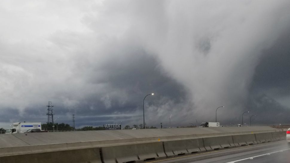
Severe weather spins up a rotating wall cloud across Central Florida. (Spectrum News)
According to the National Weather Service, from a period between 1950 and 2009, El Niño winters produced 248 tornadoes for Central and South Florida. Compare this to 186 tornadoes during what would be deemed a normal “neutral” winter season. Seven of those tornadoes were violent EF3 tornadoes or higher.
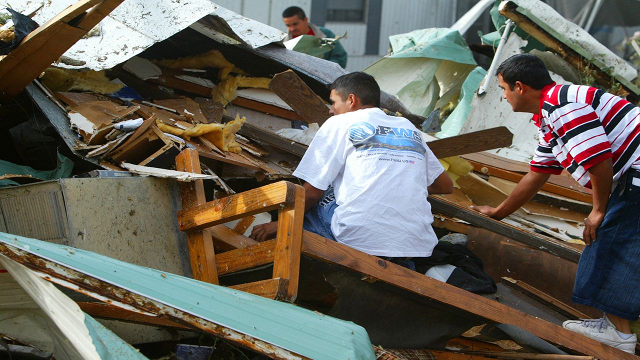
A rare Christmas Day tornado touches down in 2006, causing major damage to this structure. (AP Photos)
El Niño winters have a profound impact on the weather in the Southeast, affecting everything from rainfall patterns to temperature extremes and severe weather events.
Understanding these effects can help communities and governments prepare and adapt to the challenges posed by this natural climate phenomenon. While El Niño brings both benefits and challenges, being informed and prepared is key to mitigating its effects on the region.
Our team of meteorologists dives deep into the science of weather and breaks down timely weather data and information. To view more weather and climate stories, check out our weather blogs section.