A large storm system crossed the Rockies over the weekend. It produced rain and snow in parts of Wyoming and Montana. On Monday it pushed east toward the Plains as a cold front developed along it.
This system will encounter a warm moist area in the center part of the country helping to support thunderstorm development. Simultaneously, a low pressure will ride along this front, enhancing the storms.
Heavy rain and flooding will be possible with already saturated grounds and swollen waterways.
What You Need To Know
- Tornadoes will be likely in the center of the country on Monday
- Severe threat continues overnight into Tuesday morning for parts of Kansas, Missouri and Iowa
- Another round of storms is possible on Tuesday for Kentucky, Indiana and Ohio
- With unstable air in place on Wednesday, a large severe weather outbreak is possible along the Midwest
With storm fuel in place and the advancing system, severe thunderstorms will be possible from the Plains to the Mississippi River Valley. This will not be a one-day event. Severe weather will be possible from Monday through Thursday.
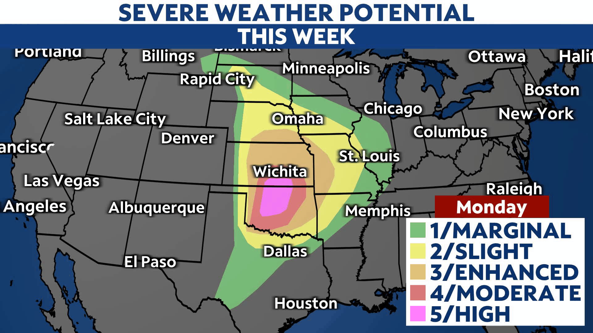
Severe weather potential this week
The Storm Prediction Center categorized the severe threat on Monday as 5/5 for parts of Oklahoma and Kansas. A “Particularly Dangerous Situation (PDS)” Tornado Watch was activated for this region with meteorologists forecasting large and potentially violent long-tracking tornadoes.
Storms will also be capable of producing damaging winds with gusts up to 75 mph and large, baseball-sized hail. The watch continues into the overnight hours.
A threat level of 3 and 4/5 extends from Oklahoma and Kansas into Missouri and Nebraska. Large hail, damaging winds and tornadoes are also possible in these locations, however, tornadoes, while still possible, are not expected to be as widespread.
Further east into eastern Missouri, Arkansas and Iowa, the severe threat continues overnight. A risk of 2/5 means damaging winds, quick spin-up tornadoes and hail will be possible. Be sure to enable your weather notifications before you head to sleep.
By Tuesday, the severe potential pushes east in Kentucky, Indiana and Ohio. The region is under a level 2/5 for severe weather with damaging winds and hail as the biggest threats.
Another low pressure develops along the frontal boundary on Wednesday, enhancing the threat for Missouri, Arkansas, Illinois, Indiana, Kentucky and eastern Texas. The Storm Prediction Center already categorized the threat as a level 3/5 with all impacts expected on Wednesday afternoon into the evening. Those impacts include tornadoes, damaging winds, hail and heavy rain.
With the system moving off to the south and east on Thursday, the front will trigger storms for areas from New Jersey south through North Carolina and east-central Texas.
Monday’s timing
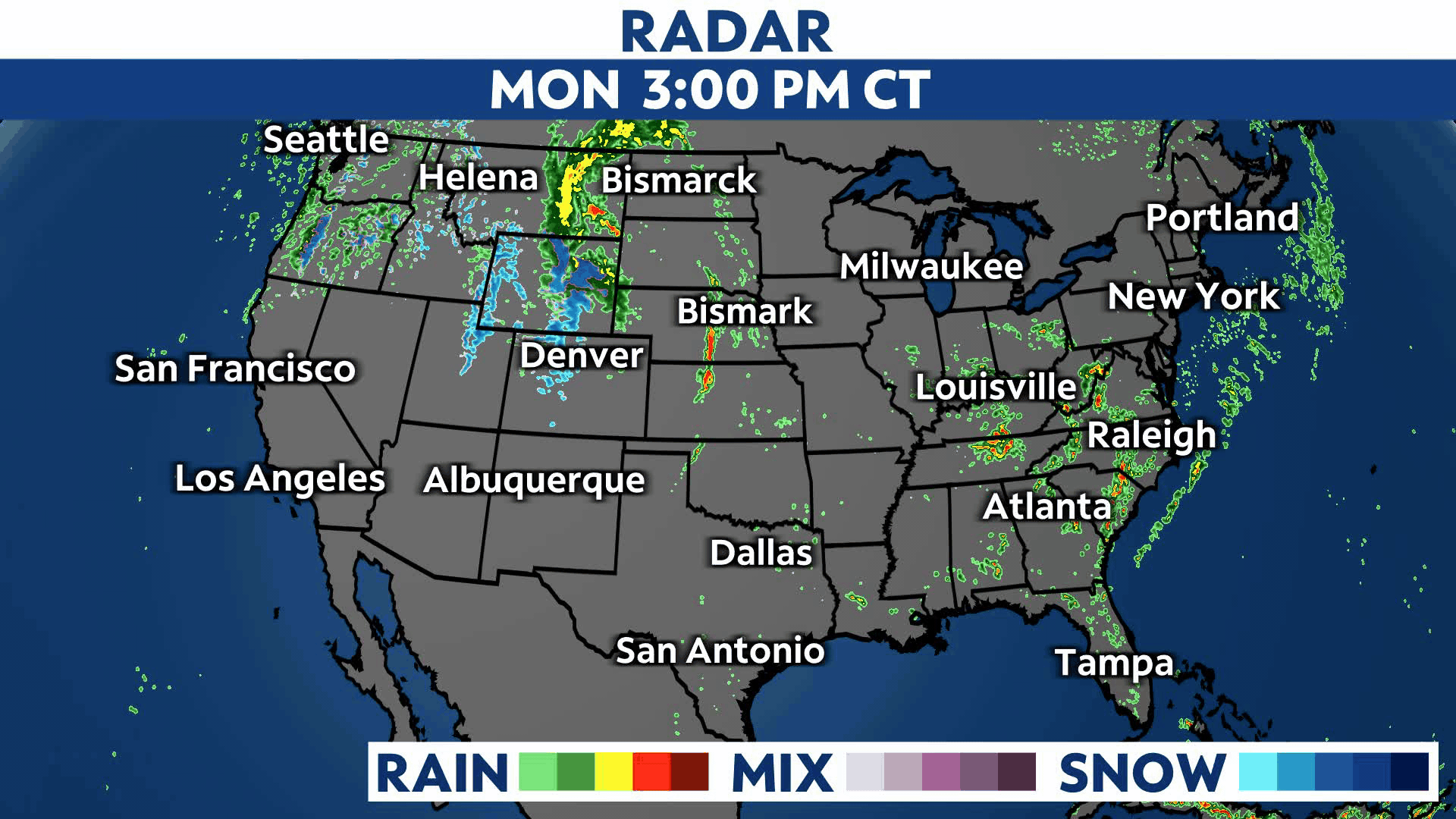
With daytime heating and low-level moist conditions in place, severe storms will begin developing late afternoon into the evening and continue during the overnight hours.
By Tuesday morning, the severe threat will be much less, but the front won’t quite push through the region.
Tuesday’s storms are conditional
The severe potential on Tuesday depends on what happens during the day. Depending on how quickly the atmosphere destabilizes will determine if storms develop Tuesday afternoon and evening.
Storms will be possible along the Ohio River Valley, including Kentucky, Indiana and Ohio. There is a lower end threat for severe weather.
Wednesday has a higher threat for severe weather
Another low pressure will ride along the slow-moving cold front. This will enhance the thunderstorms and could produce a higher-end threat in the Mississippi River Valley and Ohio River Valley regions.
All severe risks are possible, including tornadoes, damaging winds, large hail and heavy rain.
Our team of meteorologists dives deep into the science of weather and breaks down timely weather data and information. To view more weather and climate stories, check out our weather blogs section.