Weather patterns flow when high and low pressure systems work in tangent. As one concedes its power, the other gains dominance for a time before handing power over to its counterpart again.
But when there’s a stalemate between the two, a Rex block can result.
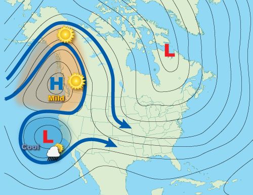
Named after its founder, meteorologist Daniel F. Rex, the “Rex block pattern” takes place an area of high pressure sits over an area of low pressure. In this scenario, both systems are equal in strength, which locks them in place. Hence, an atmospheric block is born.
Graphic showing an example of a Rex block setup. (NOAA)
Like other blocking patterns, a “Rex block” pattern enhances drought conditions for some, while lowering the thresholds for flooding to others, depending on where it’s centered.
While “Rex block” patterns typically set up over the West Coast, they can form over the East Coast as well.
Rex blocks and tropical weather
Even though it wasn’t retired from the recycled list of Atlantic hurricane names in 2016, Hermine was still a noteworthy storm. It was not the strongest to affect U.S. soil, but its track and oscillating intensity were unforgettable for some.
Hermine made landfall as a Category 1 hurricane along the Florida Panhandle early on Sept. 2, 2016. It quickly weakened to a tropical storm as it tracked northeast over Georgia and the Carolinas, where it still brought heavy rainfall and gusty winds.
The storm continued on its north-eastward path, becoming a post-tropical cyclone as it moved off coast of North Carolina. Thereafter, it encountered an area of high pressure to the north that was congruent in strength, causing it to somewhat stall.
Despite drifting slowly toward the north, the resulting “Rex block” kept Hermine off the North Carolina and Mid-Atlantic coast for days.
Heavy rainfall and combined with strong onshore flow brought significant flooding across parts of eastern North Carolina, especially for the Outer Banks and areas closer to the coast..
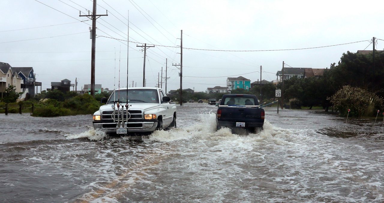
A Rex block pattern held Hermine off the coast of North Carolina and the Mid-Atlantic in early September 2016. The photo above shows flooding in Hatteras, North Carolina, caused by the storm. (AP Photo/Tom Copeland)
While Hermine didn’t impact the Mid-Atlantic as much as it was originally forecast to, it still generated gusty winds, rough surf and dangerous rip currents along the parts of the Northeast coastline as it continued to spiral for days offshore before eventually dissipating.
Our team of meteorologists dives deep into the science of weather and breaks down timely weather data and information. To view more weather and climate stories, check out our weather blogs section.