As the first rush of colder air arrives across the United States, Americans everywhere are preparing themselves for the upcoming winter.
Even though Florida escapes the bitter cold and snow that many up north see, we still have to prepare ourselves for our own winter weather pattern. One that might bring rounds of strong winds and tornadoes.
Florida historically has two severe weather seasons – one during the spring and one during the late fall into early winter months. Historically, spring provides a better shot for severe weather across the state.
Rounds of storms are common during the fall and early winter months as big bursts of cold arctic air head south toward the warmer, more humid air mass of Florida. This provides a perfect recipe for storms to become strong to severe.
Of course, we also have our sea breeze thunderstorms each afternoon during the summer which can bring severe weather to the area, but these storms are often weaker than an organized severe weather event and very short-lived in comparison.
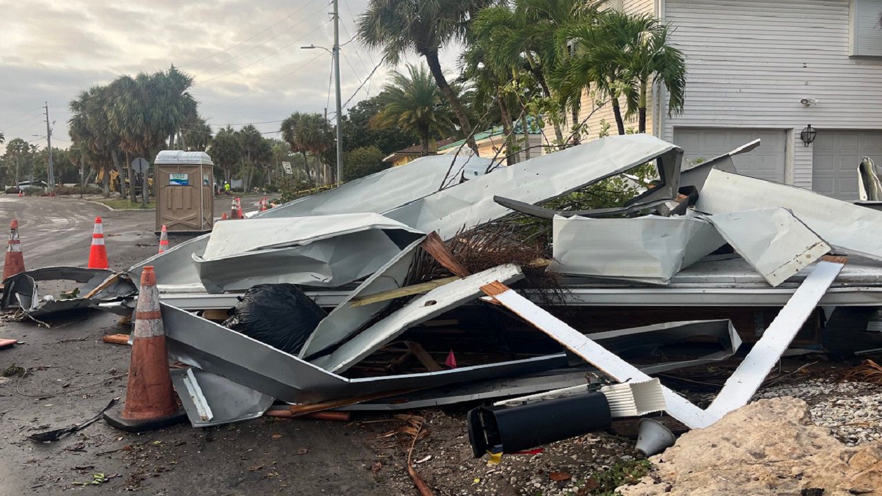
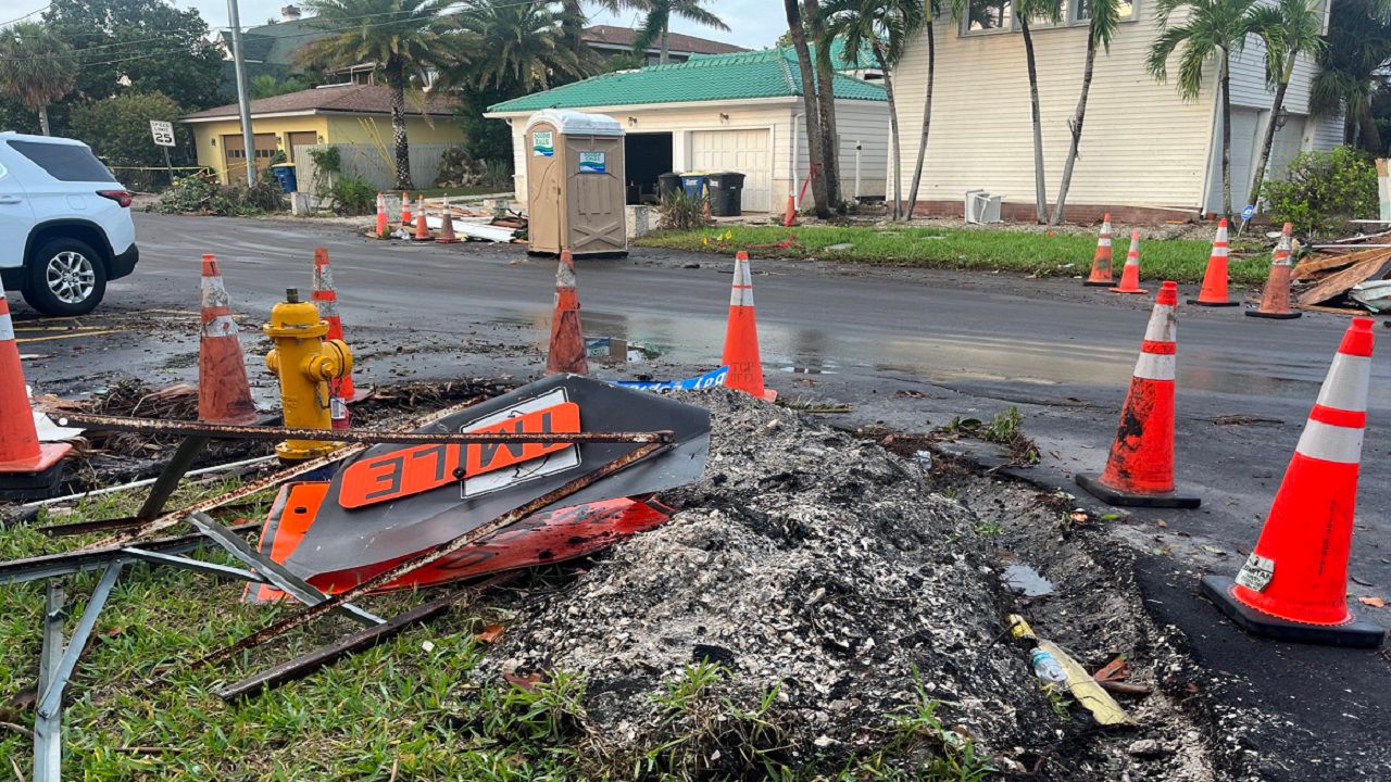
A pile of debris from the EF1 tornado sits across from Carlouel Yacht Club in Clearwater, Fla. (Spectrum News/Angie Angers)
Strong winds, frequent lightning and tornadoes are all a common feature during severe weather seasons. With the warm Gulf of Mexico moisture overhead and plenty of wind shear from approaching cold fronts, tornadoes may develop along these frontal boundaries easier than they would any other time of the year.
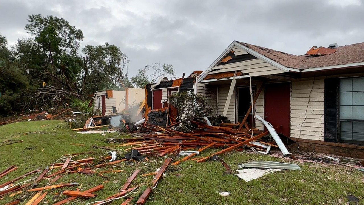
The Ridgeview Apartments in Crystal River sustained heavy damage overnight as the storms and tornado came across the region. (Spectrum News/Chris McDonald)
Tornadoes may seem to be more common across states like Oklahoma, Texas or Mississippi, but Florida has a higher frequency of tornadoes per 10,000 square miles than any other state, according to the Florida Climate Center.
The coastline between Tampa Bay and Fort Myers holds the lead for the highest frequency of tornadoes with parts of the western panhandle in a close second.
Why does Florida get so many tornadoes?
Florida’s hold on first place for most tornadoes per 10,000 square miles largely comes from tornadoes that develop during the summer months, not during our winter or spring severe weather seasons.
During the summer, short-lived tornadoes can develop as sea breeze boundaries collide. These brief spin ups can last for seconds, or a few minutes, before dissipating. The reason for the short duration is because of the lack of wind shear, or energy, within the atmosphere.
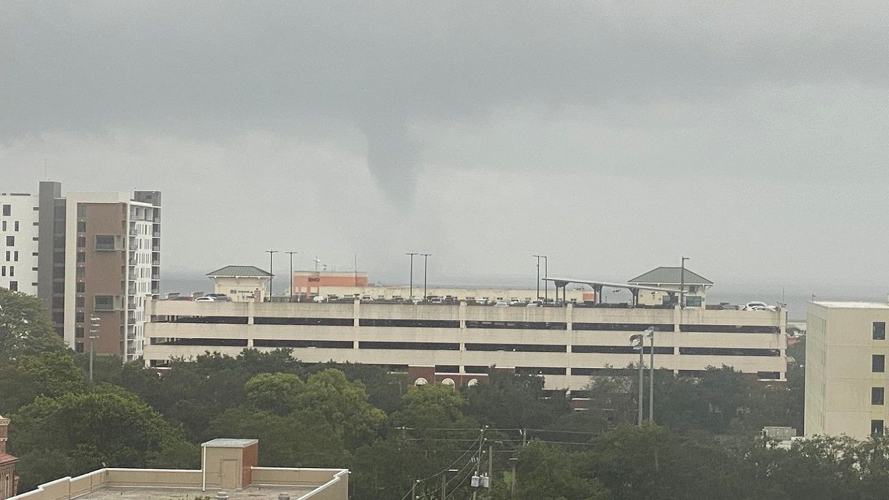
A waterspout is spotted in St. Petersburg, Fla. before pushing onshore. (Spectrum News)
Tornadoes during the severe weather season months have more wind shear to feed off of, in order to maintain their structure and strength for a longer period. These boundary collisions last for a very short amount of time, and thus, so do the tornadoes that spin up within them.
Because of all the boundary collisions we get during the summer months, our tornado count outpaces the rest of the nation, which relies on frontal boundary passes for their tornado count. But while they may see a higher count of more intense tornadoes, most of the tornadoes we see statewide are weak and short-lived.
According to the Florida Climate Center, only 41 tornadoes in the state have been rated (E)F3 or higher since 1950.
Why doesn’t Florida get long-track tornadoes?
As mentioned, most of the tornadoes that happen in the state come from boundary collisions during the summer months. These sea breeze boundaries have very short-lived conditions in the atmosphere that tornadoes only last for seconds to minutes on average.
So why don’t we see more long-track tornadoes like those in Oklahoma, Mississippi or Alabama? They largely rely on cold front passages for their tornadoes. And those frontal passages have better dynamics for long-track tornadoes to thrive.
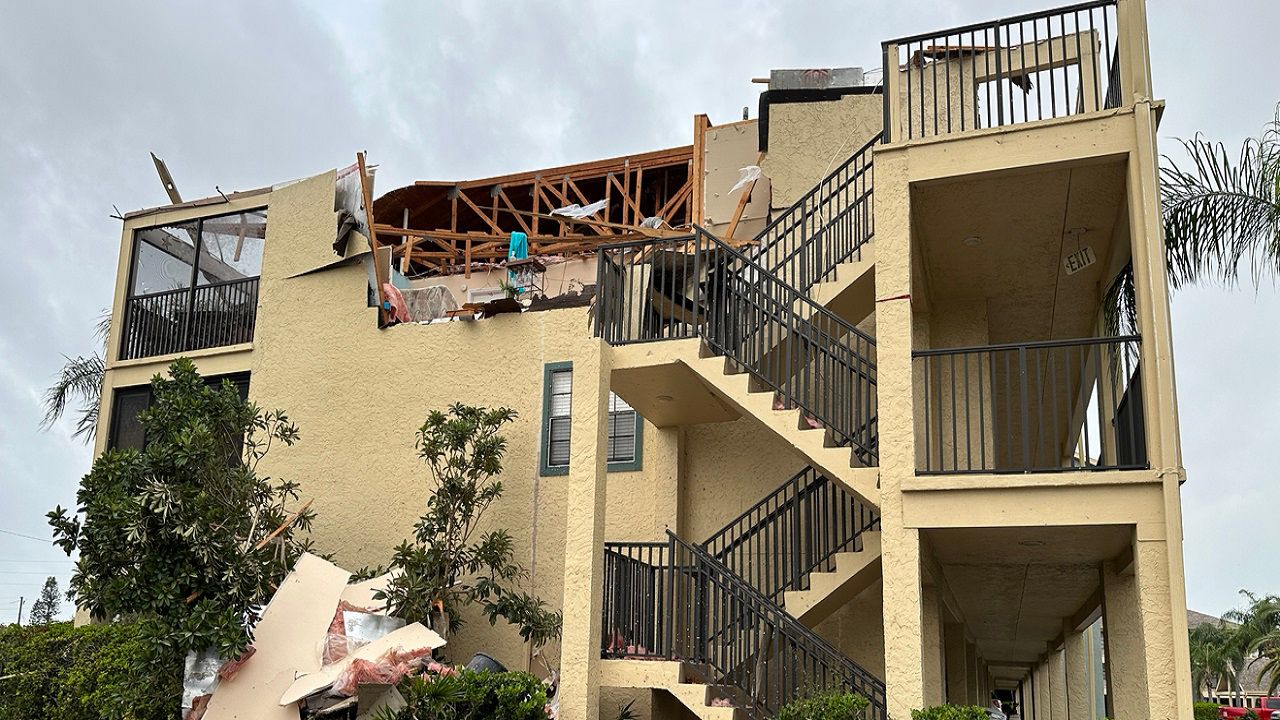
Overnight storm and tornado damage at the Harbor Pointe condo building on Causeway Boulevard in Dunedin. (Spectrum News/Angie Angers)
As a cold front passes by, the very cold air mass behind the front rams into the warm and humid air mass ahead of the front. This creates a lot of instability, or storm fuel, along with chaotic wind directions which can fuel tornadogenesis.
Once a tornado forms, it can feed off that storm fuel and wind shear for hours, leading to a path of widespread destruction that can go on for up to hundreds of miles.
In Florida, the Gulf of Mexico acts as our saving grace. While it provides widespread warmth ahead of approaching cold fronts throughout the deep south, that frontal boundary must push over the Gulf of Mexico before it ever reaches the Florida peninsula.
This forces the very cold air mass behind the front to moderate, warming it up before it once again clashes with even warmer, more muggy air ahead of the boundary in Central Florida.
A pile of debris from the EF1 tornado sits across from Carlouel Yacht Club. (Spectrum News/Angie Angers)
Warming of the cold air mass provides less of a temperature gradient across the front, which also reduces the amount of storm fuel and wind shear the front has to work with. This lessens our threat for long-track tornadoes throughout the Florida peninsula.
While rare, we have had at least one instance of a long-track tornado in the state. Back on April 4, 1966, an F4 tornado began its path of destruction in Clearwater, before moving across North Tampa Bay and through the Carrollwood area.
This tornado continued northeast, clobbering anything in its path. It eventually lifted as it pushed into Merritt Island on the eastern part of the state before the storm exited into the Atlantic Ocean. 11 people died from this tornado and another 530 Floridians were injured.
Our team of meteorologists dives deep into the science of weather and breaks down timely weather data and information. To view more weather and climate stories, check out our weather blogs section.