Florida’s enchantingly warm water and bountiful sunshine are a major attraction for millions of tourists every year. As the summer month’s return, the state’s leading cause for weather-related fatalities lurks just beneath the water – rip currents.
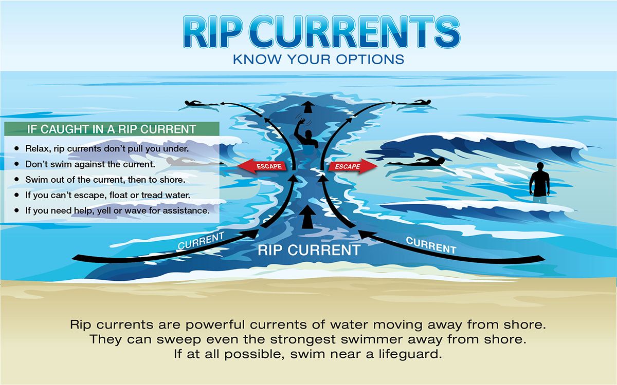
Rip currents are covert hazards found along Florida’s coastline. These powerful waves crash near the shoreline, creasing a swift channel of water that flows away from the coast and out to sea.
These narrow channels of fast-moving waters can pull experienced swimmers several hundred yards out from the shoreline.
Tragically, these rip currents can exhaust swimmers as they fight to leave the grip of the rip. The intense pull of the rip current can cause swimmers trapped within the current itself to panic, which can lead to drowning.
A rip current is spotted of the coastline. (NOAA)
Rip currents and rough ocean conditions cause around 22 deaths in Florida each year, according to the NOAA.
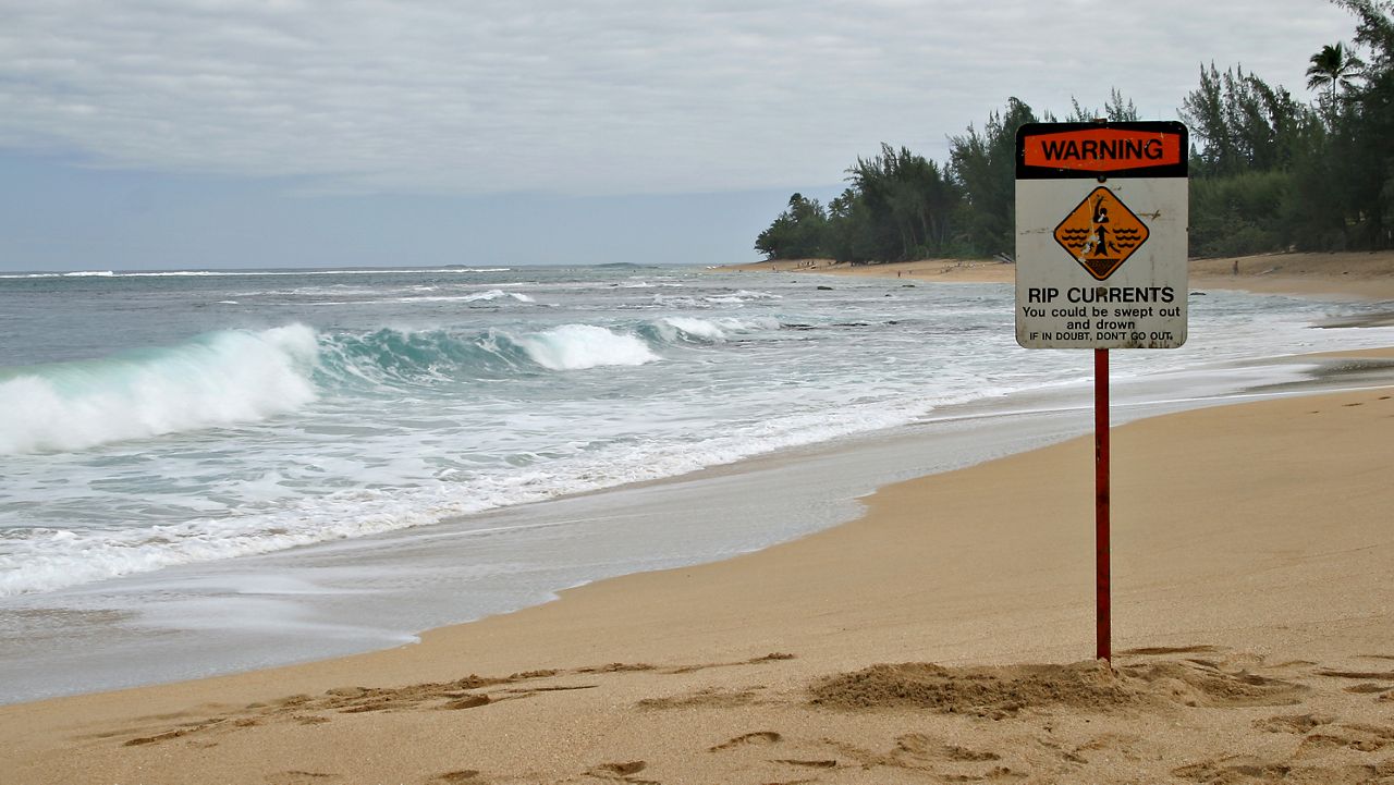
No one part of Florida is safe from the threat of rip currents. These marine hazards can develop along any shoreline and go unnoticed by beachgoers.
It’s important to understand how to spot them and to practice good beach safety. Swimming at only at guarded beaches and heeding beach warning flags that may be flying is a good start.
How to spot a rip current
Rip currents are strong and narrow channels of water that flow away from the coastline and out to sea. These channels can be spotted in the air, but while you’re along the beachfront, many could go unnoticed by normal beachgoers.
The best way to avoid finding yourself in a rip current is to swim at only life guarded beaches. You can also identify them yourself by looking for certain aspects of the water.
The best way to spot rip currents is from an elevated position. This is one reason lifeguards have lifeguard towers. An elevated position will give you an overlook to spot where channels of water are heading out to sea versus heading toward the shoreline.
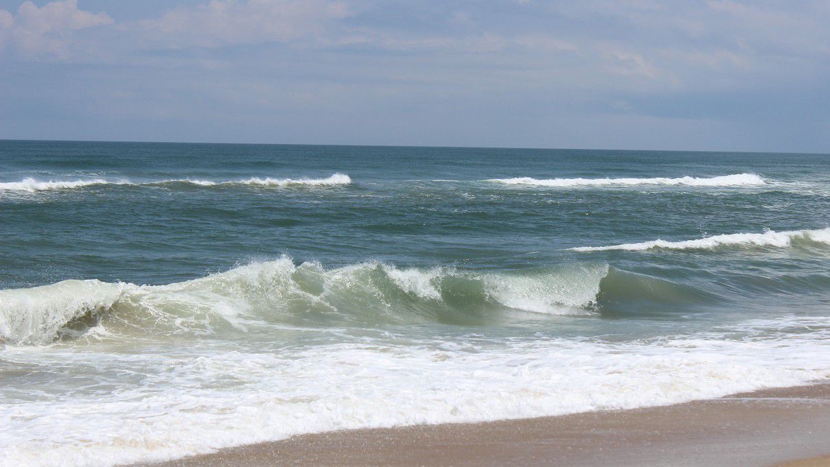
Rip currents can form along any beach in Florida. (NOAA)
Another way to spot a rip current is to identify darker, narrow gaps of water heading offshore. These narrow channels typically are found between breaking waves and white water. It’s these darker channels of water that represent the rip current pulling under and out to sea.
Know how to spot the rip current (NOAA)
You can also look for narrow regions of choppy or rippled water. These areas are often associated with steeper breaking waves along the shoreline as the offshore rip current flow leads against the onshore wave flow.
This can change the water’s texture and can steepen the waves as they roll ashore.
Finally, look for plumes of sand or ocean foam offshore beyond the breakers. These turbulent motions of the water signal a deeper force beneath the surface, typically that of a rip current.
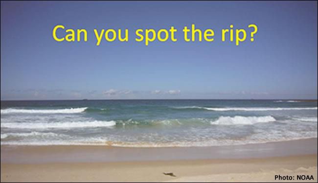
Can you spot the rip? (NOAA)
Remember, above all, follow any lifeguard or official when it comes to beach safety. If a rip current exists, they’ll hoist a series of beach flags. Understand their meaning.
- Green flags show that the risk for water hazards is very low. You should remain vigilant as marine hazards can change throughout the day, and sometimes over a brief period.
- Yellow flags mean marine hazards exist, typically in the way of some rip currents. Swimming is not advised for those swimmers that are not experienced in spotting rip currents or swimming in ocean waters.
- Red flags mean major marine hazards exist. Rip currents can be very strong and swimming, even for experienced and strong swimmers, is discouraged.
- Purple flags show that marine life is present in the surf area. In Florida, that can include jellyfish, but can also include the risk for small fish, crabs and even the occasional shark sighting.
NOAA is helping to forecast rip currents
In April 2021, NOAA launched the first-ever rip current forecast model. The goal – to better predict and forecast this marine hazard in order to keep beachgoers safe around the nation’s beachfront.
This model, now entering its second year in operation, provides forecasters the ability to produce forecast up to six days in the future. The forecast provides a probability of a rip current existing along several points in a National Weather Service Office area of responsibility.
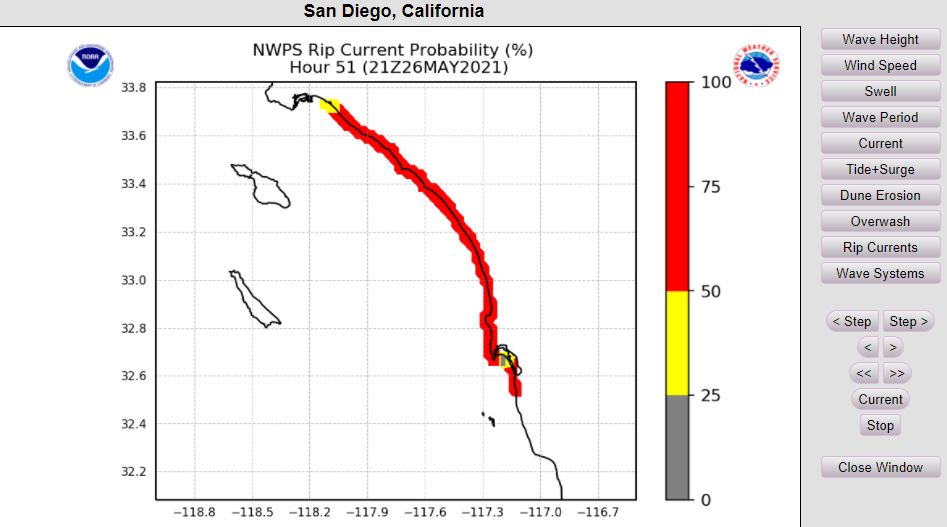
An example image of the National Rip Current Forecast Model (NOAA)
The model, a joint effort between NOAA’s National Ocean Service and the NWS, worked on upgrading the Nearshore Wave Prediction System, a product that ingests waves and water-level data across the globe.
This data is then fed into the computer model, and like various other weather forecasting models, spits out a probability of dangerous rip currents occurring along the coast.
You can check out the National Rip Current Forecast Model here.
Our team of meteorologists dives deep into the science of weather and breaks down timely weather data and information. To view more weather and climate stories, check out our weather blogs section.