A significant storm system is expected to move through the southern Plains beginning Sunday evening and overnight, bringing the potential for damaging winds, embedded tornadoes, hail and strong thunderstorms.
The NWS Storm Prediction Center is forecasting a derecho to develop later this evening around southwest Oklahoma and the eastern Texas Panhandle, which will race east overnight.
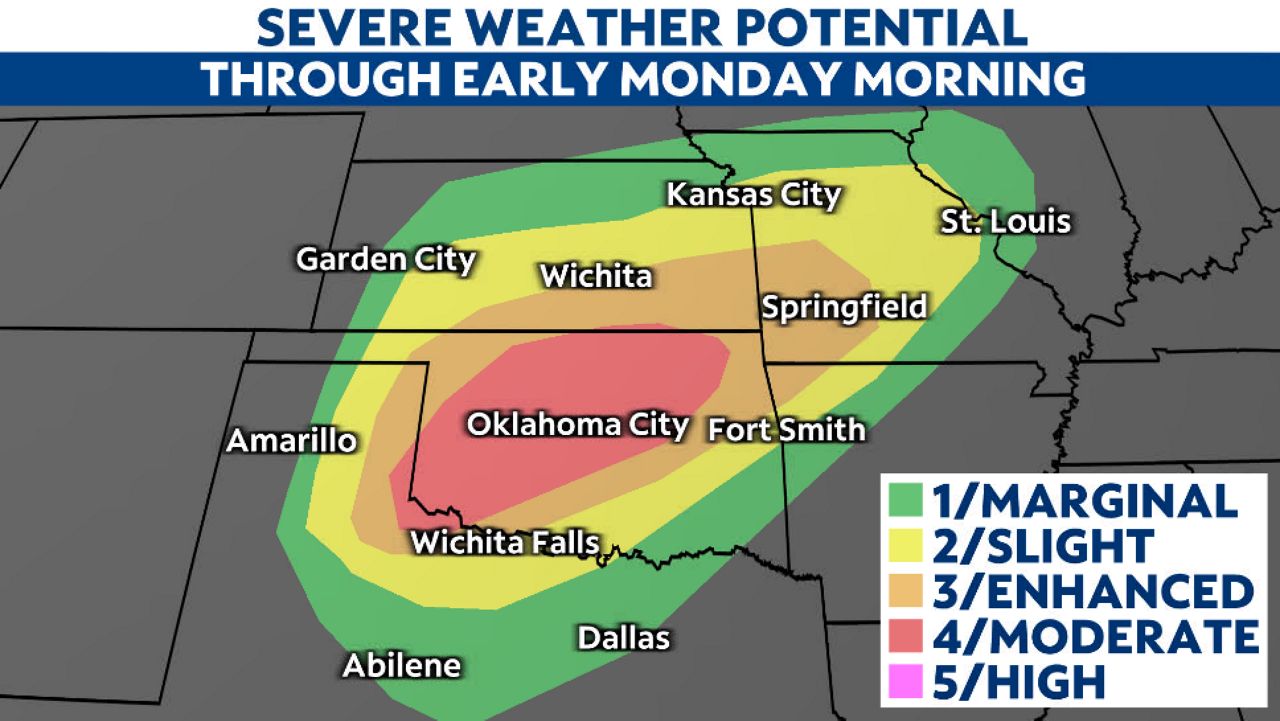
The forecast
Storms will develop Sunday evening from the eastern Texas Panhandle into southwest Kansas. These cells will be capable of producing damaging winds, large hail and a few tornadoes.
These individual cells will merge into a line of storms, or derecho, and move through Oklahoma this evening and tonight, producing wind gusts in excess of 80 mph.
The Storm Prediction Center has issued a moderate risk (level 4/5) for severe weather this evening and overnight for a large portion of Oklahoma.
Southwest Oklahoma will have the greatest potential for strong tornadoes this evening.
Storms will race east this evening and overnight through Oklahoma, with severe storms also possible for parts of Texas, southern Kansas, northwest Arkansas and Missouri.
What is a derecho?
A derecho is a widespread, long-lived windstorm associated with a band of rapidly moving showers or thunderstorms.
The destruction is similar to tornadoes, but the damage is usually directed in one direction.
Not every severe storm that passes through is a derecho. There are distinct characteristics that classify a weather event as a derecho.

Derechos are not very common, but they can cause more widespread damage than a tornado because of the storm’s size and how far it travels.
You can learn more about derechos and how they form here.
Our team of meteorologists dives deep into the science of weather and breaks down timely weather data and information. To view more weather and climate stories, check out our weather blogs section.