It’s been a mild start to March across the Eastern U.S., but colder air has moved in and we will see more cooldowns and temperatures swings in the upcoming week.
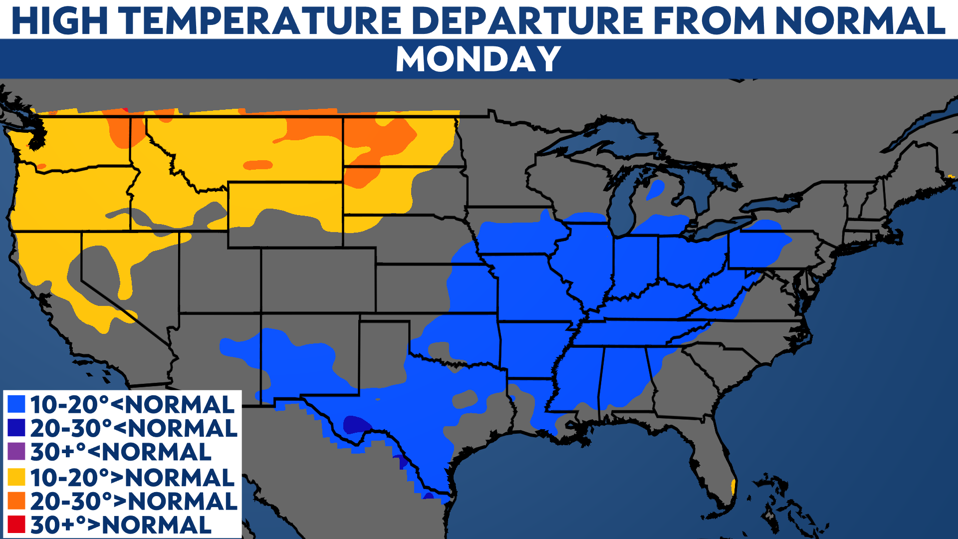
A cold front pushing across the country has dropped high temperatures up to 10 to 20 degrees below normal for parts of the Midwest and Ohio Valley on Monday.
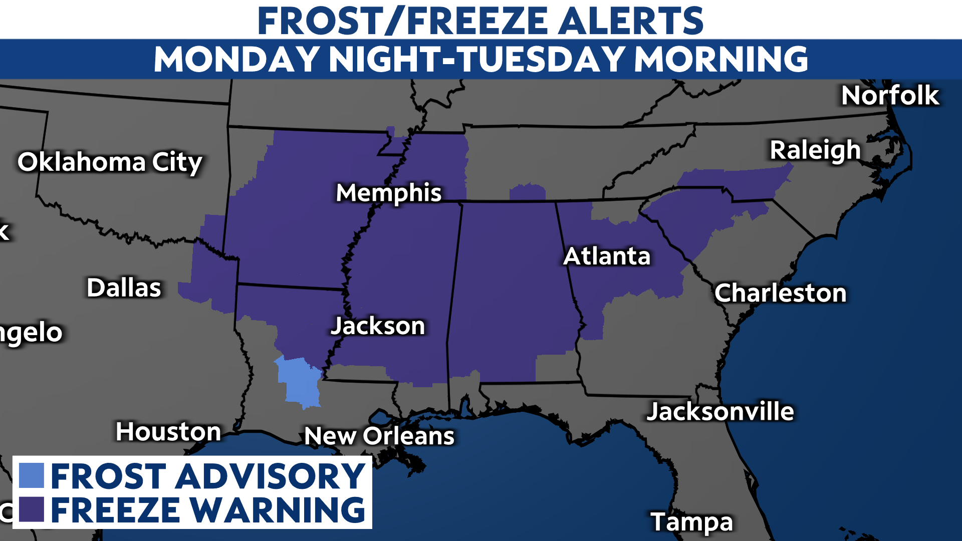
Further south, sub-freezing temperatures in the forecast for tonight have led to Freeze Warnings being issued across the Deep South, stretching from Texas to North Carolina.
Colder air and below normal temperatures follow the cold front to Florida and the Deep South on Tuesday as temperatures rebound quickly across the Central U.S.
An active storm pattern will keep temperature swings in the forecast across the country through the week, with more cold blasts and wintry weather opportunities in the Great Lakes and Northeast through midweek and again this weekend.

March so far
Most places east of the Rockies are running warm this month. Average temperatures are well above normal through March 17, with areas across the Midwest, Ohio Valley and Northeast feeling a top-10 warmest March on record so far.
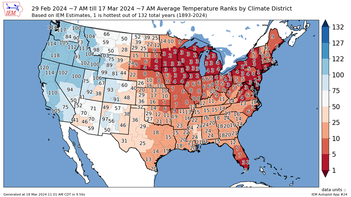
(Iowa Environmental Mesonet)
Meanwhile, the western U.S. has been running cool with below normal temperatures. With the exception of the Northeast and Florida, it is probable that the rest of the U.S. will close out the month with temperatures around or below normal.

Our team of meteorologists dives deep into the science of weather and breaks down timely weather data and information. To view more weather and climate stories, check out our weather blogs section.