The mild spring weather that many have enjoyed in March will hit a big bump as the calendar turns to April. Yes, a powerful cold front will be a reminder that we’re not done with cold weather just yet.
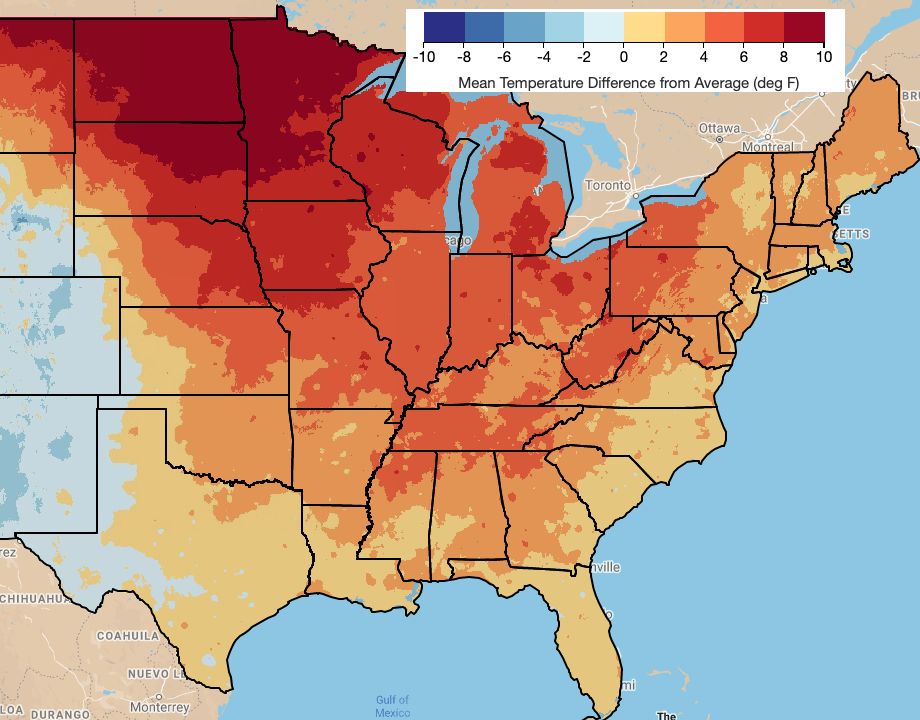
The average temperature so far in March has been above normal over virtually the entire eastern United States. That’ll make this cold shot, no matter how brief, a more bitter pill to swallow.
Difference from average temperature in March. (Climate Engine)
Temperatures will sharply drop as the front passes through the Ohio Valley early Wednesday, then steadily bulldozes west to east across New York throughout the day. We could even see a 10-degree drop in an hour’s time as it hits.
This same front drops colder air into North Carolina Wednesday night, finally pushing all the way into Florida early Thursday.
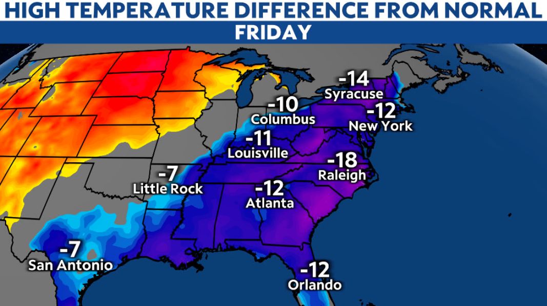
While the cooldown will be most noticeable for a short time–Thursday through Saturday morning–it’ll be quite a change from what has been around lately. Temperatures will be about 10 to 20 degrees below normal, putting a definite late-winter feel in the air.
Widespread freezing temperatures are likely, even diving into the Carolinas. Those who already planted will need to protect those plants Thursday night and Friday night.
We can expect record cold temperatures in many places Thursday and Friday, possibly into Saturday morning.
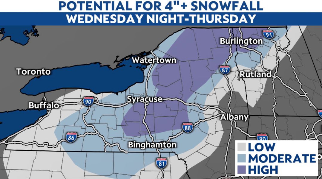
Oh, and this thing isn’t bringing just cold. Rain turns to snow in the Upstate New York Wednesday night, lingering into Thursday. At least a few inches of snow are likely in parts of that state, tapering off closer to New England.
Temperatures gradually warm this weekend into next week.