We’re about to pay for the exceptionally warm December over much of the country as a powerful arctic blast is about to push in.
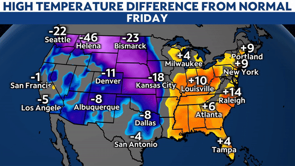
The bitter cold air has already entered the Northern Plains and Northern Rockies, and will continue spilling southward this weekend into next week. Temperatures will tank as much as 30 to 40 degrees below average for an extensive region stretching from Canada to Texas.
The big chill then sprawls eastward next week. Although its bite won’t be quite as harsh, it’ll still send high temperatures plunging 20 degrees below average.
The arctic air will challenge or break dozens of daily record temperatures for both morning lows and afternoon highs. Much of the north-central U.S. will have at least a few days straight of below-zero wind chills.
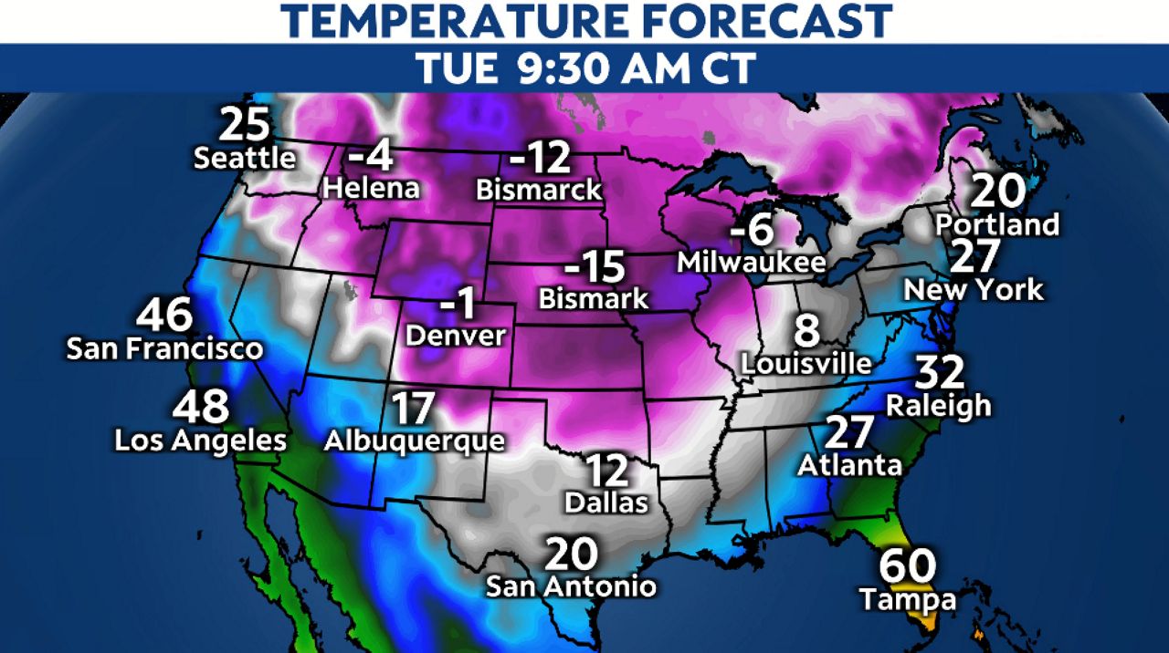
Subfreezing temperatures will become their most expansive Tuesday morning, reaching all the way to the Gulf coast. That covers over 80% of the population of the Lower 48.
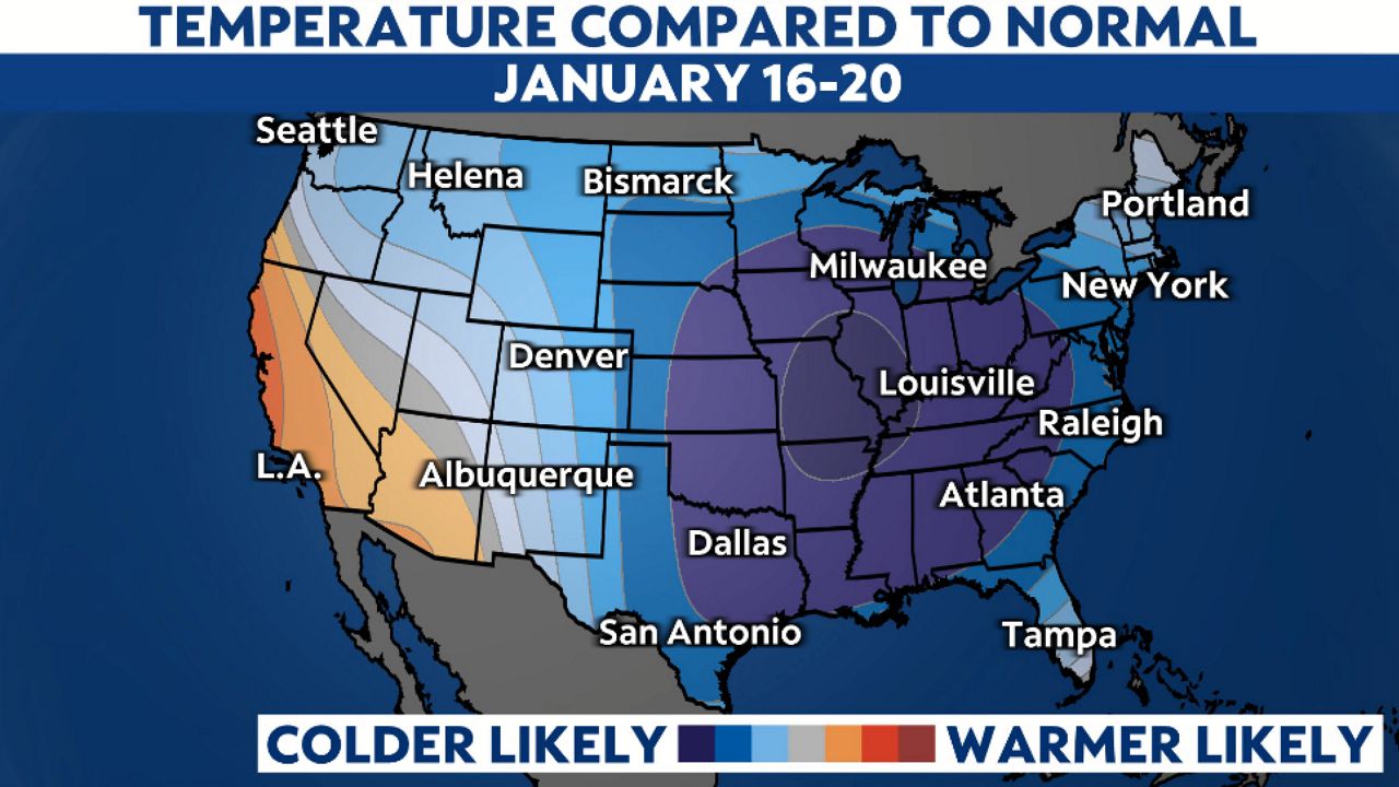
Even though the frigid blast will ease as the week goes on, it won’t fully disappear. In fact, signs point to chilly weather persisting into next weekend as another shot of cold air dives in from Canada.
This is easily the harshest cold wave of the season so far. Check your local forecast to know when to plan for the coldest weather, and take a look at the stories below to be ready for the bitter blast.
Our team of meteorologists dives deep into the science of weather and breaks down timely weather data and information. To view more weather and climate stories, check out our weather blogs section.