States around the country are using new technology to mitigate natural disasters, from wildfires to flooding.
California is expanding a camera and sensor network to understand causes and aftereffects of wildfires and other natural disasters.
The University of California San Diego (UCSD) just launched ALERTCalifornia.
It’s a public safety tool that assists first responders in natural disaster response and a variety of climate hazards. They also have a public platform that people can use to survey the conditions in their neighborhood too.
ALERTCalifornia manages a vast network of over 1,000+ cameras, sensor arrays and artificial intelligence that provides real-time information to public safety agencies.
It’s separate from ALERTWilfire which is a tool that monitors wildfires in Arizona, Idaho, Montana, Nevada, Oregon, Utah and Washington.
ALERTCalifornia is a multi-hazard system.
It’s a supreme collaboration between scientists, emergency personnel and state officials.
For example, fire agencies can determine the amount of resources it needs to dispatch using the ALERTCalifornia network.
I spoke to professor Neal Driscoll, director of ALERTCalifornia and geoscientist at UC San Diego’s Scripps Institution of Oceanography about the program.
“The whole purpose of this project is to keep firefighters safe while they keep us safe,” Driscoll told me.
Watch the video above to learn about ALERTCalifornia and why it could be a critical tool in natural disaster response.
Over 100 public agencies use ALERTCalifornia.
The network can track wildfires over 50 miles away, identify hotspots and provide real-time situational awareness for firefighters.
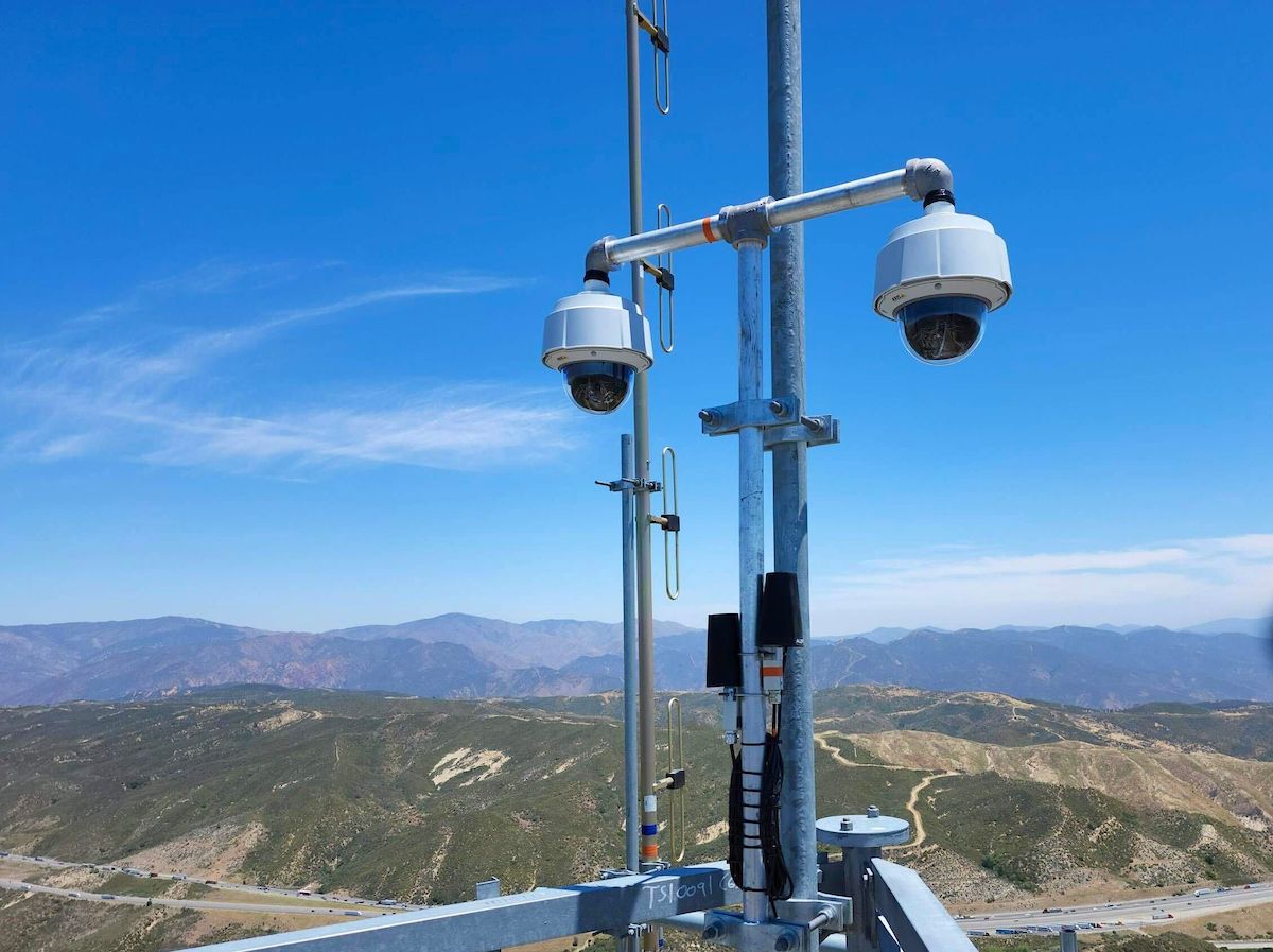
An ALERTCalifornia sensor network array that includes two cameras overlooking the landscape. These are two of the more than 1000 cameras that monitor California. (ALERTCalifornia/UC San Diego)
ALERTCalifornia will also become a critical tool in collecting information about other climate hazards posing risks to California, from atmospheric rivers to landslides.
“These fires have cascading disasters on water quality, air quality, soil quality. We need to better characterize the threats so we can use data to drive decisions,” said Driscoll.
ALERTCalifornia will continue to grow with new technology as it helps state and local agencies to stay head of the next wildfire or weather threat.
Driscoll says there has been some interest in Canada in creating a network similar to ALERTCalifornia since they deal with destructive wildfires and other climates hazards as well.
Our team of meteorologists dives deep into the science of weather and breaks down timely weather data and information. To view more weather and climate stories, check out our weather blogs section.