Christmas is just a week away, and who may have snow on the ground for the holiday is becoming clearer.
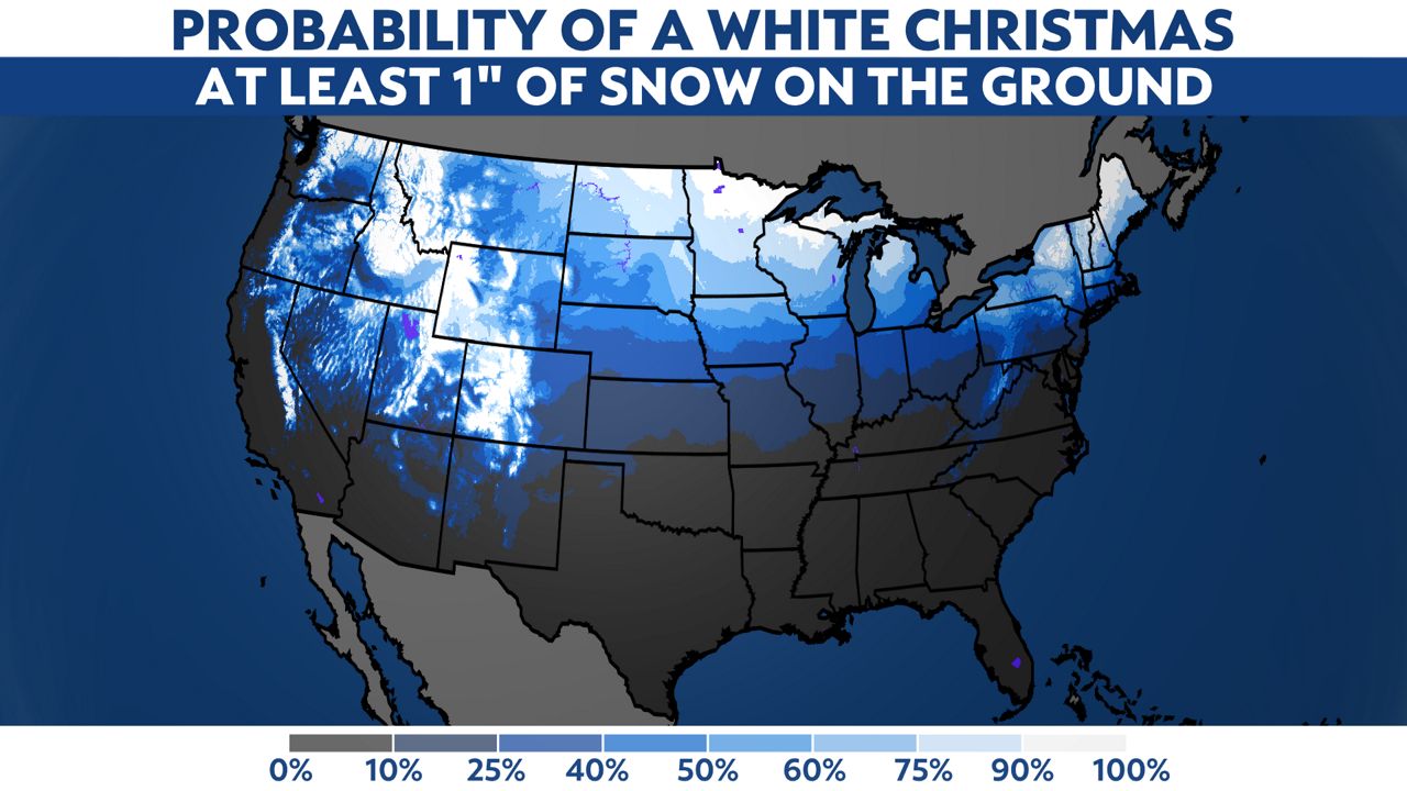
A white Christmas is one with at least an inch of snow on the ground; it doesn’t have to fall that day. The historical odds of a white Christmas are highest where you’d expect: generally farther north and in higher elevations.
Persistent snow cover has been scarce lately, thanks to above-normal temperatures in some places that ought to be chilly by now. For the first half of the month, a relatively small part of the country has had an average high cold enough to maintain snow.
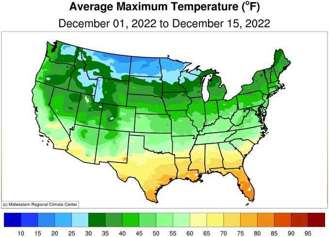
(Midwest Regional Climate Center)
A big pattern change will flip the switch to “cold” leading up to Christmas. But what about the actual snow?
Here’s what one computer forecast model’s “ensemble” says the snow depth will be on Christmas Day. It’s the average of 50 different tweaks to the model (kind of like “two heads are better than one,” but in this case, it’s 50).
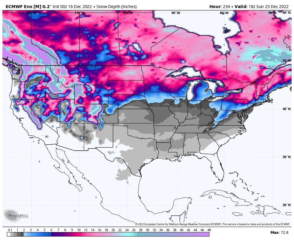
(WeatherBELL)
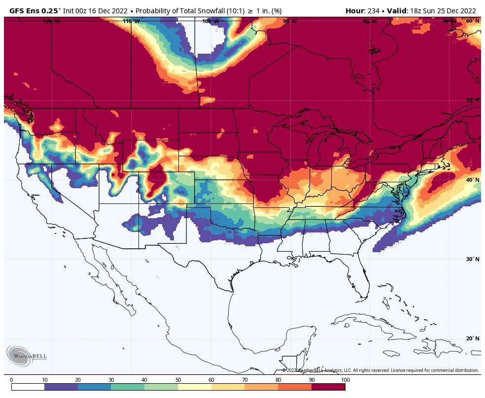
While there’s color showing up pretty far south, don’t get excited (or worried?) about that right away. Some of those fringe amounts aren’t much more than noise, since only a fraction of the 50 computer models actually predict an inch of snow falling there between now and Christmas.
Whites and purples are where fewer than 20% of the computer model outcomes have at least an inch of snow.
(WeatherBELL)
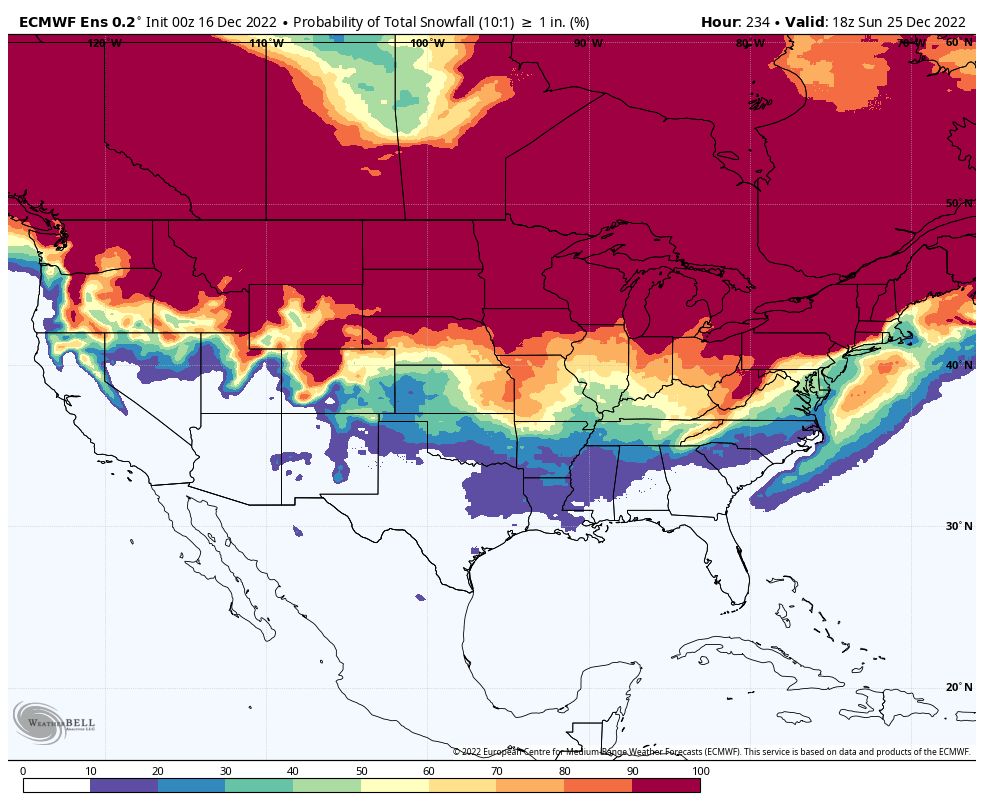
Comparing that to another ensemble forecast model, you’ll notice some similarities. Of course, details differ, but the overall themes are close.
(WeatherBELL)
Anywhere that has yellow, orange or red in both images has at least a 50/50 chance, based on a lot of computer simulations, of an inch of snow falling between now and Christmas Day. Given the weather pattern, there’s a good shot that snow will still be there on the holiday itself.
Current signs suggest that parts of the Midwest, Ohio Valley and mid-Atlantic have higher odds than usual of seeing a white Christmas. It’s too early to make promises for those farther south, so keep tabs on your local forecast just in case!
Our team of meteorologists dives deep into the science of weather and breaks down timely weather data and information. To view more weather and climate stories, check out our weather blogs section.