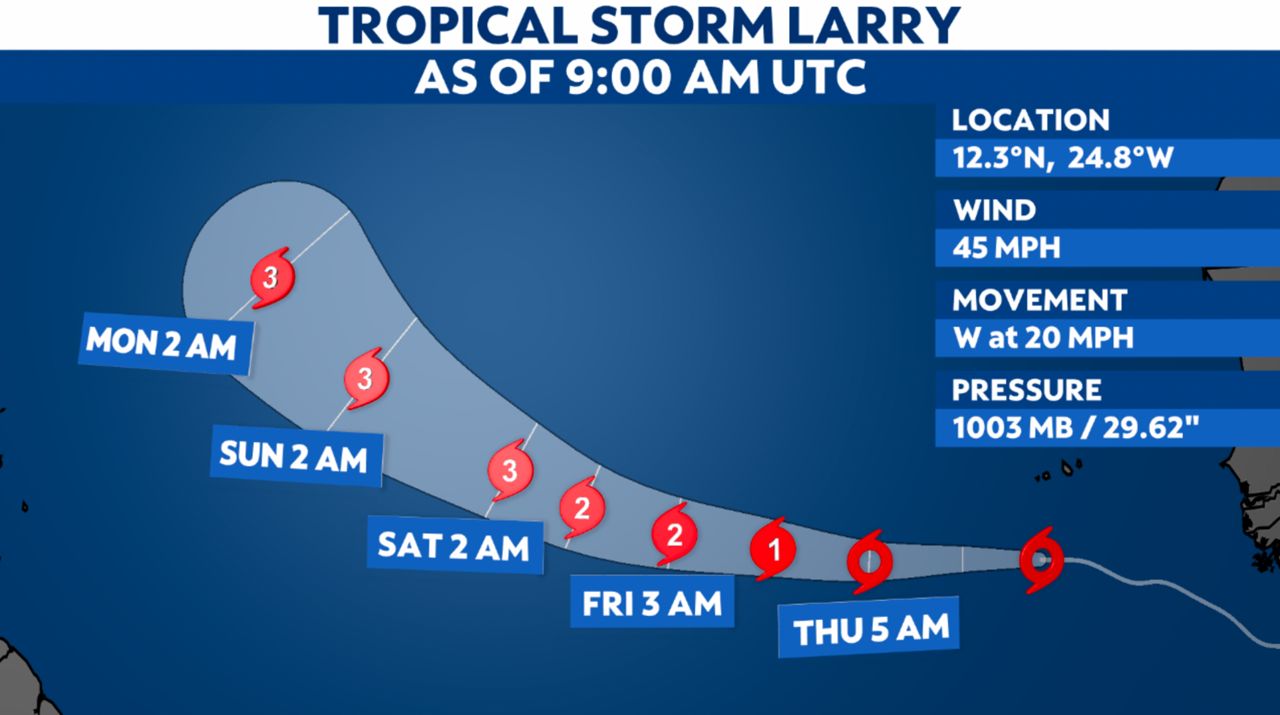
Tropical Storm Larry formed in the open Atlantic Wednesday morning.
A tropical wave that rolled off the coast of Africa earlier this week became Tropical Depression Twelve on Tuesday evening. It wasted no time strengthening into a tropical storm.
The storm is in the open Atlantic, heading west. It will remain on that path this week, eventually turning more toward the northwest this weekend.
Larry is forecast to remain far from land for the foreseeable future. Any direct U.S. impacts, if any, are many days away.
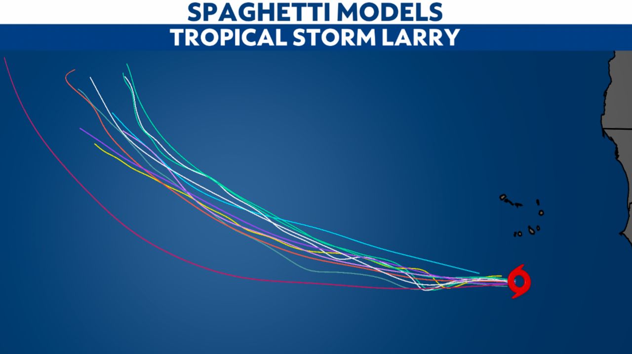
Spaghetti models trace a path toward the northwest over the next 10 days. However, these will certainly shift somewhat over time.
Spaghetti models or plots show a series of individual computer forecast models together on one map. They are useful to give insight into whether multiple models are in agreement on the path of the storm, but they do not address the storm’s forecast intensity, winds, flooding and storm surge potential or other data. Tap here for more details on how best use these models.
Ida continues to drop heavy rain across parts of the eastern U.S., though. Tropical Depression Kate is over the open ocean, and a disturbance in the western Caribbean has a low chance of development.