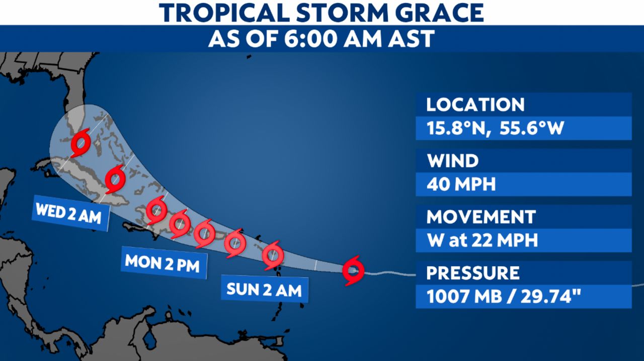
Tropical Storm Grace has formed to the east of the Leeward Islands.
Grace has winds of 40 mph and is moving west. Impacts to the Leeward Islands will begin as early as tonight and into Sunday morning.
The U.S. Virgin Islands and Puerto Rico will see impacts tomorrow.
Strong winds, heavy rain and flash flooding are possible for these areas over the next few days.
Florida is in the forecast cone, so impacts to the U.S. are possible. However, it is very early in the forecast, and this could always change. We’ll keep you updated if anything changes over the next few days.
Nonetheless, the spaghetti models indicate a general westward movement.

Spaghetti models or plots show a series of individual computer forecast models together on one map. They are useful to give insight into whether multiple models are in agreement or not on the path of the storm, but they do not address the storm’s forecast intensity, winds, flooding and storm surge potential or other data. Tap here for more details on to best use these models.
We’re also watching Tropical Depression Fred, which will bring impacts to the U.S. this weekend. Get the details here.
Tropical Alerts
Tropical Storm Warnings have been issued for:
- Northern Leeward Islands
- The U.S. Virgin Islands
- The British Virgin Islands
- Puerto Rico
A Tropical Storm Watch is in effect for:
- Part of the British Virgin Islands