Strong storms are moving in from the Gulf of Mexico and pushing east.
Sign up for severe weather alerts
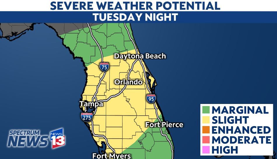
Strong to severe storms continue to move through Central Florida, and they are packing a punch.
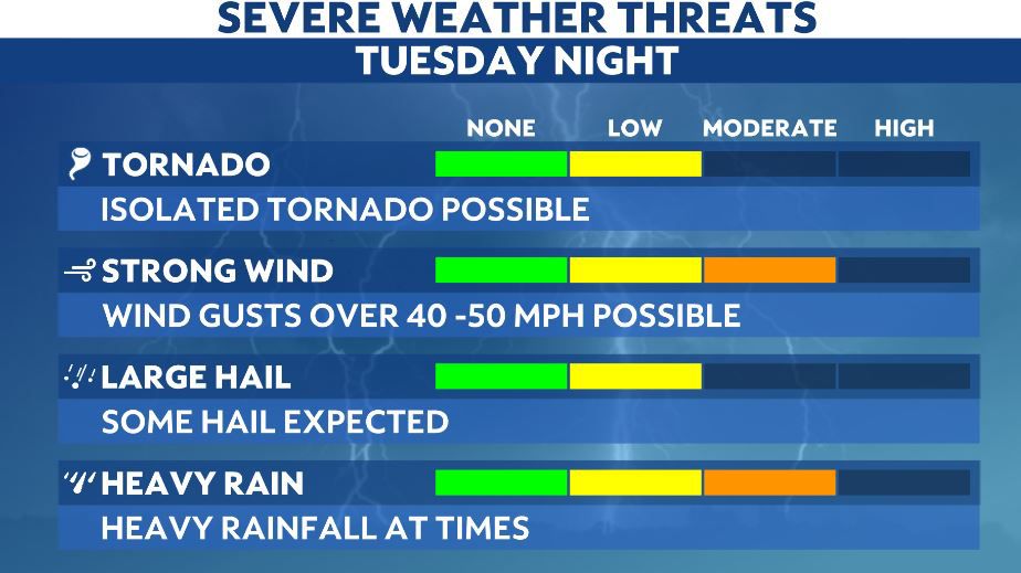
Downpours, gusty winds, hail and an isolated tornado are all possible until these storms end around 2 a.m. Wednesday.
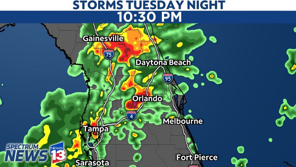
We’ve already seen several Severe Thunderstorm Warnings and Tornado Warnings pop up to the west of Orlando in Sumter and Lake Counties.
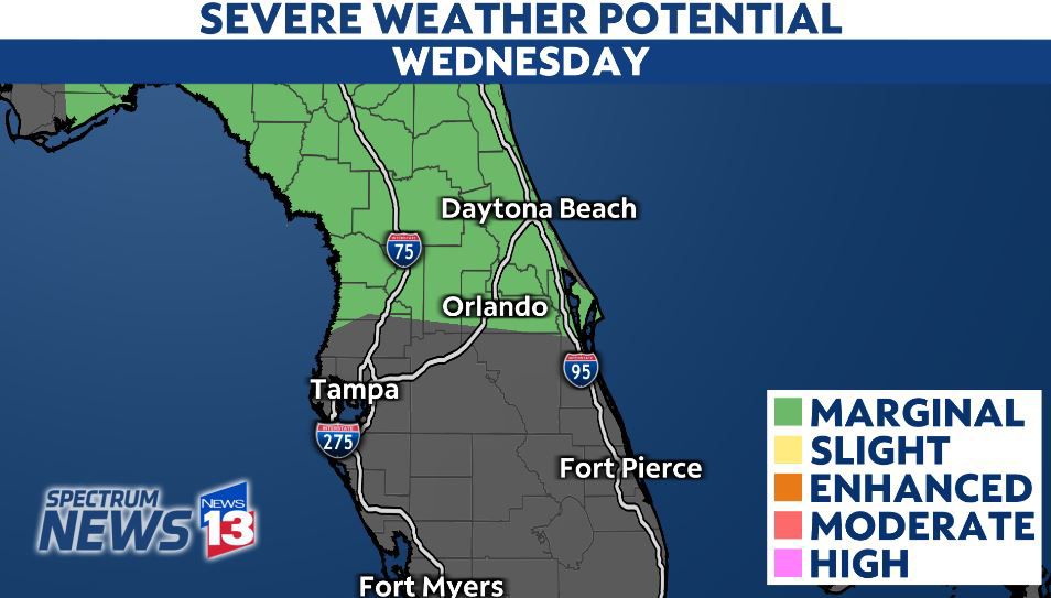
Another round of showers and storms could develop by Wednesday afternoon. However, the coverage of rain will be much lower and the chance for severe weather will also be lower.
It is best to have multiple ways to receive severe weather alerts in case a storm impacts your neighborhood into the overnight hours.
One way is to download the Spectrum News App. Once you download the app, go into the settings and turn on the notifications for weather alerts.
Another way is to have a NOAA Weather Radio. This will alert you of any warnings that the National Weather Service may issue for your area.
Of course, the team of dual certified meteorologists will track the storms through the night, live on Spectrum News 13.