Get ready to feel some hot temperatures on Thursday before rain returns to the area.
A cold front is eyeing Central Florida, but before it gets here, strong southerly winds will heat temperatures up to near-records for Thursday afternoon.
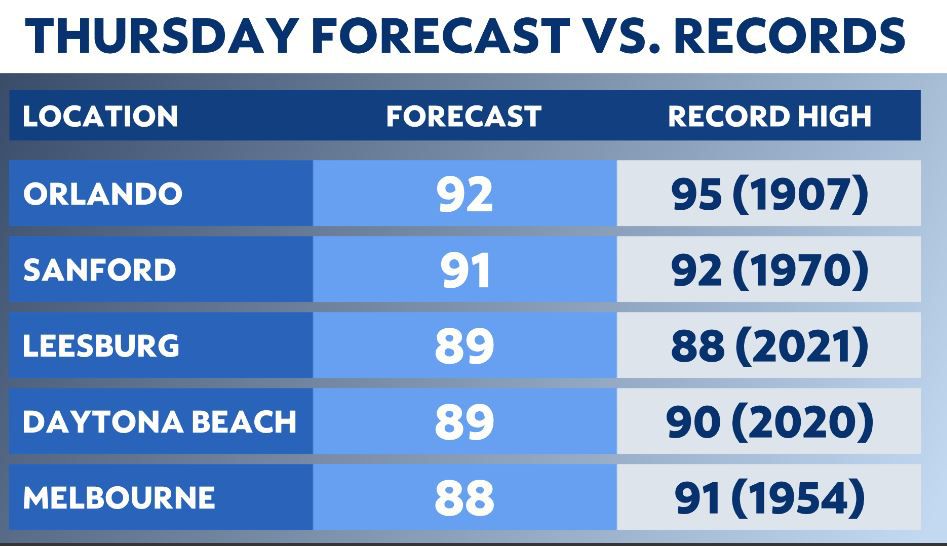
Sanford, Leesburg and Daytona Beach will be the closest to tying or breaking records.
Orlando will likely stay shy of the record, which is 95 degrees. That was last set in 1907.
The weather experts at Spectrum News 13 are forecasting a high around 92 degrees on Thursday afternoon. It could be the hottest so far for the City Beautiful in 2022, but not quite a record.
The average high in Orlando right now is 81 degrees.
It will be so hot because winds out of the south will be pretty strong. Winds on Thursday will be sustained at 15-20 mph with higher gusts.
The winds are kicking up ahead of a powerful cold front that is bringing the potential for a significant severe weather outbreak to parts of the Deep South Wednesday into Thursday.
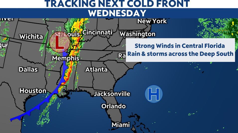
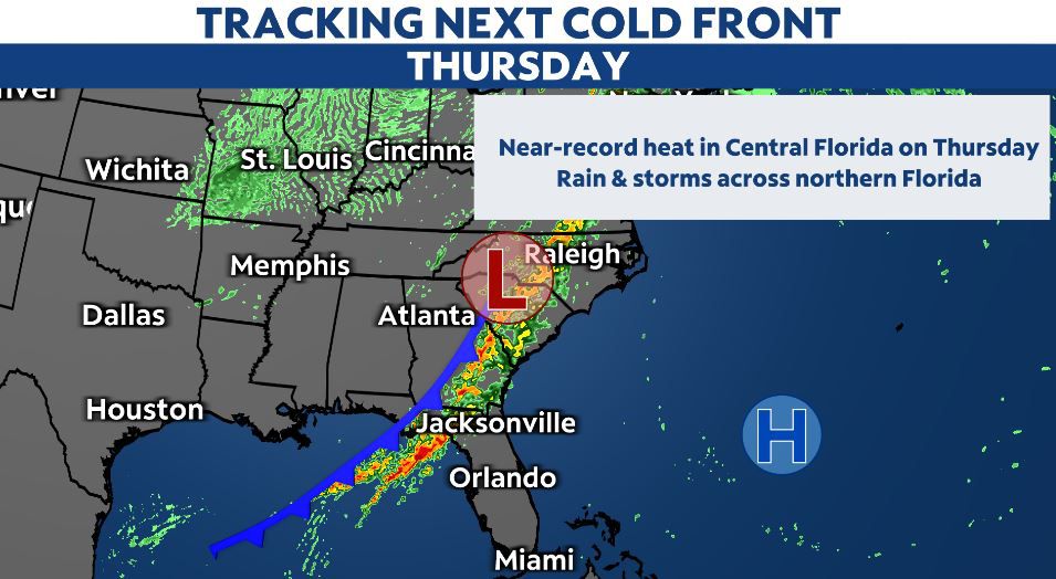
This front will head toward Central Florida late Thursday night into Friday, but it will not bring the high severe weather risk to our area.
Instead, only an isolated strong to severe storm will be possible late Thursday night for areas north and west of Orlando and Interstate 4.
The primary concern with an isolated stronger storm will be wind and small hail. Turn on your severe weather notifications here.
This front though will stall out and linger across Central Florida starting Friday into early next week.
The front, combined with little pulses of energy in the atmosphere riding along the front, could trigger off-and-on periods of rain this weekend.
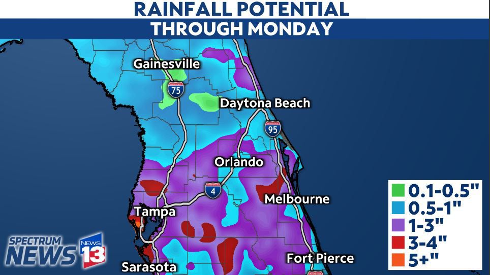
This could lead to potentially two to four inches of rain in parts of Central Florida from Friday into Monday.
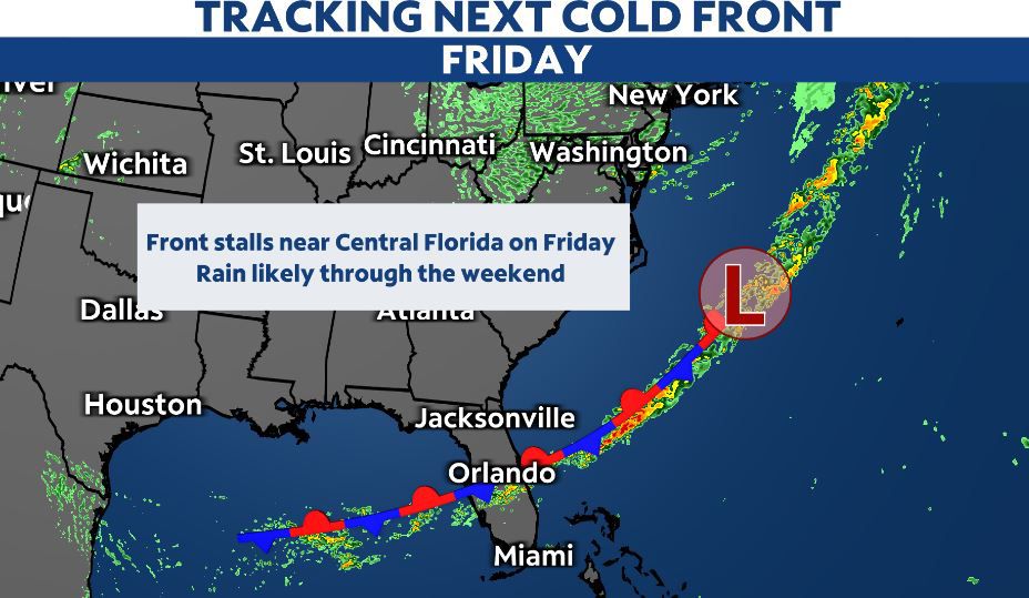
This, however, depends on the exact placement of the stalled front.
If it goes a little farther south, it may lead to more rain across South Florida instead of Central Florida.
But, if it stays closer to our area, then we could see a pretty soggy setup through the start of next week.