This winter was supposed to be warmer and drier than average because of La Niña.
That is exactly how this December through February, or meteorological winter, played out in Central Florida.
It was one of the top 10 warmest on record for parts of the region.
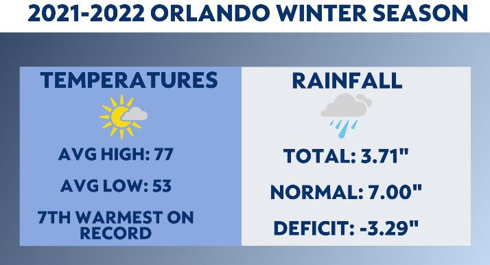
Orlando, Sanford and Daytona Beach all experienced one of the warmest winter seasons on record.
For Orlando, it was the seventh warmest on record, while Sanford finished sixth and Daytona Beach ninth.
In Leesburg, it tied for the fifth warmest winter season on record.
Average high temperatures were in the middle 70s for all spots, while the average low for the season was in the low to middle 50s.
Orlando spent 41 days with afternoon highs reaching the 80s. The most of all the six main observation sites in Central Florida.
When you break the winter season down by month, December was the warmest of the three.
Orlando averaged a high temperatures of 80 degrees in December, which is more than six warmer than normal.
Low temperatures averaged around 60 degrees, which is also more than six above average for December in Orlando.
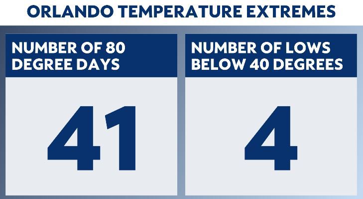
While we finally got some cold spells in January and mid-February, most spots only had a handful of mornings where the temperature dipped below 40 degrees.
The most was in Ocala. This is where the temperature dipped below 40 more than a dozen times, and three times were in the 20s.
There were plenty of cold fronts this season, but few of them produced meaningful rain.
By the end of February, we saw moderate drought expand into Marion, Sumter, Lake, and western Orange counties.
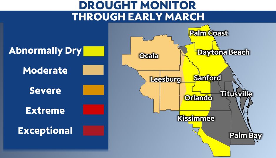
This is where the rainfall deficit has been the largest over the past three months.
Ocala finished more than five inches drier than normal.
There was not one spot above average for the season.
The largest rainfall deficits were in inland areas.
Coastal cities like Melbourne and Daytona Beach finished a little more than an inch below average.
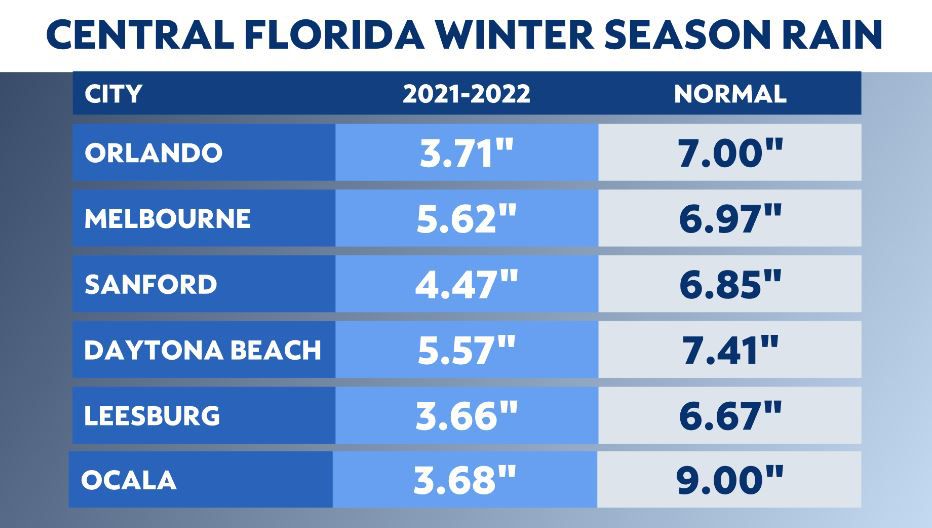
Meanwhile, Orlando, Sanford and Leesburg experienced deficits of two to three inches.
It is the dry season and rain is not frequent during these months, but even for Florida, we are heading into spring well behind where we should be for rainfall.
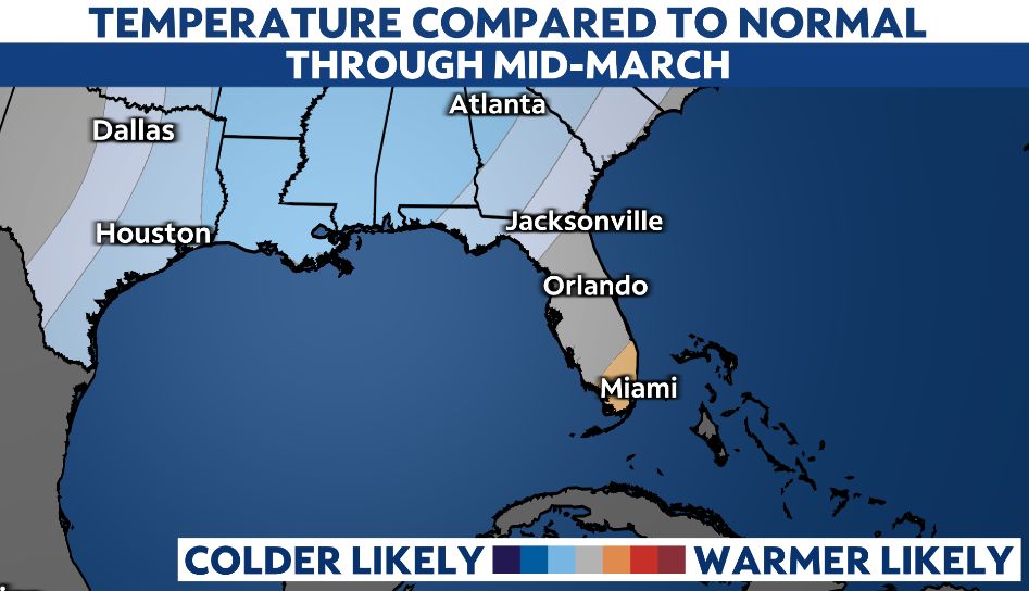
We may see the pattern change into the middle of March. There are indications that the ridge of high pressure will break down. This will allow for a stronger cold front to move into the region.
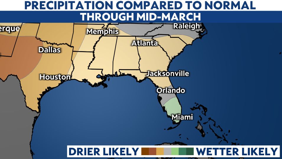
This front could bring beneficial rain and a drop in temperatures.
So after a warm start to March, temperatures may fall back to near average or even cooler than normal for at least a time.