Our first tropical system of 2022 is likely developing, and it could bring some impacts to Central Florida.
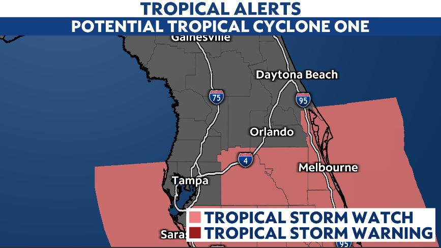
Potential Tropical Cyclone One will create the biggest impacts over south Florida and the Keys, where heavy rainfall and gusty winds will be likely.
But the system will be close enough to create some issues for our area.
A tropical storm watch is issued for Brevard and Osceola counties. The worst wind will be in south Florida, but the system could intensify further.
There remains some uncertainty about the system’s exact track. Some computer models take the rain bands over parts of Central Florida, other models keep most of the rain to the south.
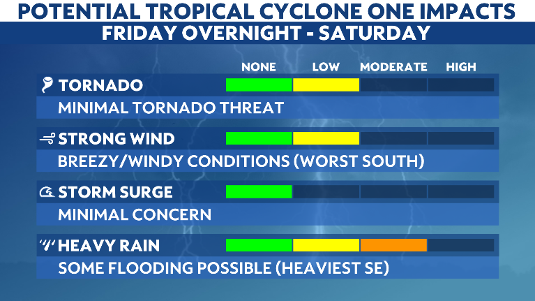
With the worst weather to the south, the threat of tornadoes with this tropical system will be minimal.
Winds will also increase late Friday into Saturday. The strongest winds will be in Osceola and Brevard counties.
With the complex coming in from the Gulf and being disorganized, we do not expect storm surge issues along the Atlantic coast.
Heavy rainfall will be the biggest concern with this complex, with the biggest concern for flooding in Osceola and Brevard counties.
The complex may organize even further late this weekend into next week as it moves into the Atlantic. This could create high rip currents along our area beaches.
The system will quickly move away from Florida Sunday, and a more typical rainy season weather pattern will take hold for next week.
Stay with Spectrum News 13 for updates around-the-clock with the developing system, and be sure to download our Spectrum News app here.