January is normally dry, but this new year started off much drier than average for most of Central Florida.
In Orlando, January is the second driest month on average. February is normally the driest.
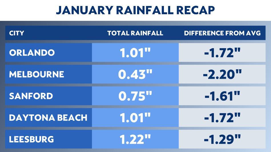
The City Beautiful only picked up an inch of rain, and that left a deficit of nearly 1.5 inches.
The driest spot was Melbourne. This is where less than a half inch of rain fell during the month.
This lack of rainfall left Melbourne with its 10th driest January on record.
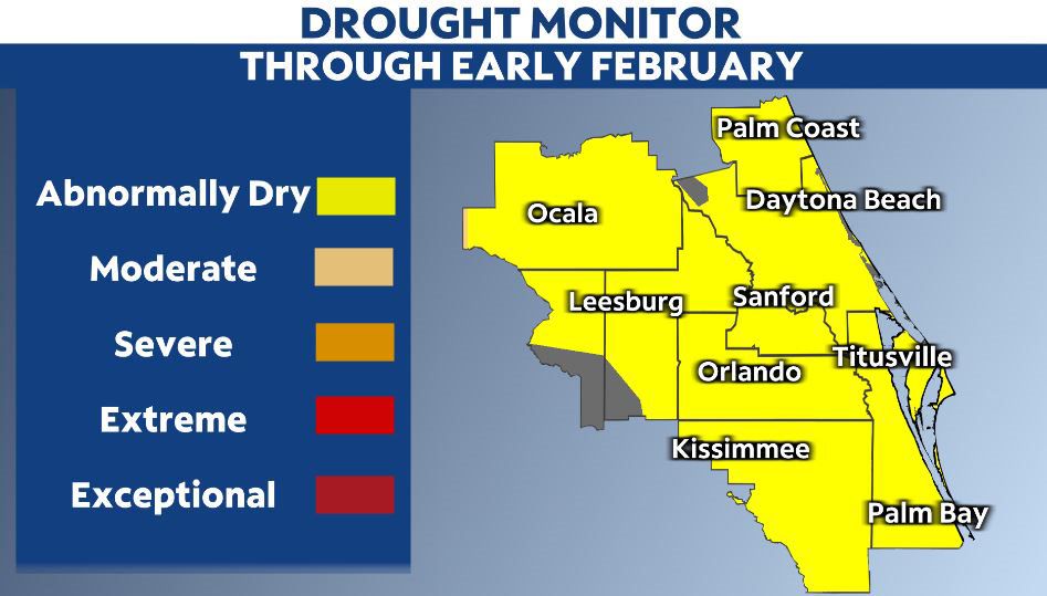
During the month of January, we watched what was once overly saturated ground because of Hurricanes Ian and Nicole quickly dry out.
The drought monitor showed abnormally dry conditions rapidly expanding into most of east central Florida by the end of the month.
Abnormally dry conditions are not drought conditions, but drought conditions have started to slowly expand across north Florida.
Temperatures
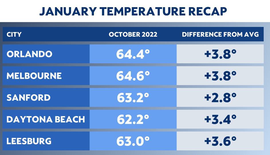
Temperatures finished warmer than normal. This in despite of a few cold snaps during the month.
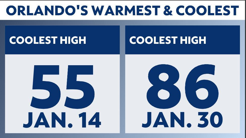
Orlando had a dozen 80 degree days while the coldest afternoon was in the 50s on Jan. 14.
While there were several chilly mornings, temperatures could recover back into the 70s under plenty of afternoon sun.
All across the region, temperatures were around three degrees above the normal monthly January temperature.
Our team of meteorologists dives deep into the science of weather and breaks down timely weather data and information. To view more weather and climate stories, check out our weather blogs section.