El Niño brings different impacts to every region across the U.S. Some areas see more wet weather during the winter while other areas stay warm or dry.
It can even help us out when it comes to seeing less activity during the Atlantic hurricane season.
What is El Niño?
El Niño and La Niña are opposite phases of the El Niño-Southern Oscillation cycle.
According to the National Oceanic and Atmospheric Administration (NOAA), this cycle describes the fluctuation in temperature between the ocean and atmosphere in the east-central Equatorial Pacific.
During El Niño, sea surface temperatures are above average in the east-central Equatorial Pacific. The temperatures have to stay more than 0.5 degrees Celsius above the long-term average for five consecutive months.
This happens when easterly trade winds falter or even turn into westerlies (winds that blow from west to east) and allow warm water to move from the western Pacific to the Americas.
This can affect weather across the entire country.
How it affects the U.S.
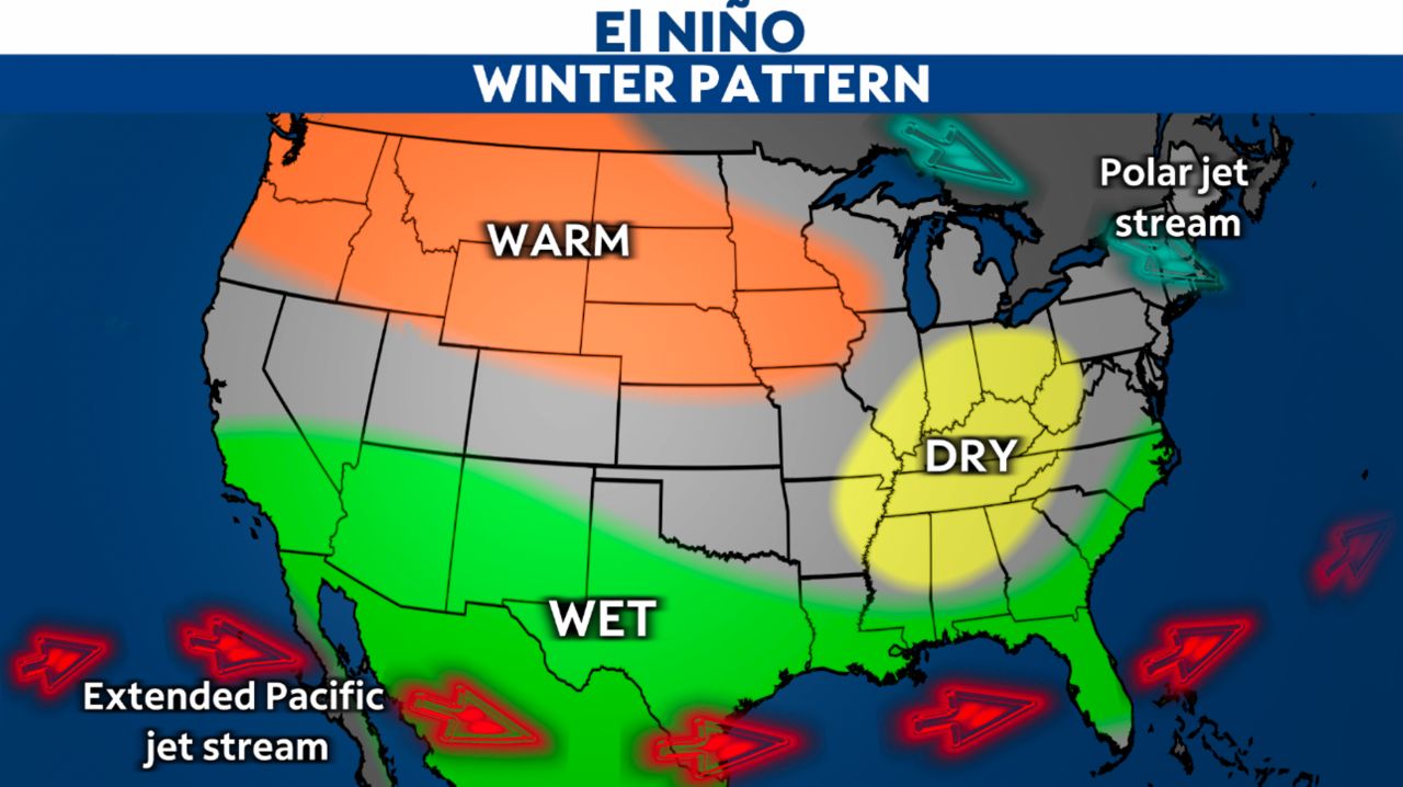
During El Niño, the Pacific jet stream moves south and spreads further east. This can cause different weather patterns for winter.
Northern half of U.S.: We see a warmer and drier winter.
Southern half of U.S.: We expect wetter-than-usual conditions for the winter.
How it affects the tropics
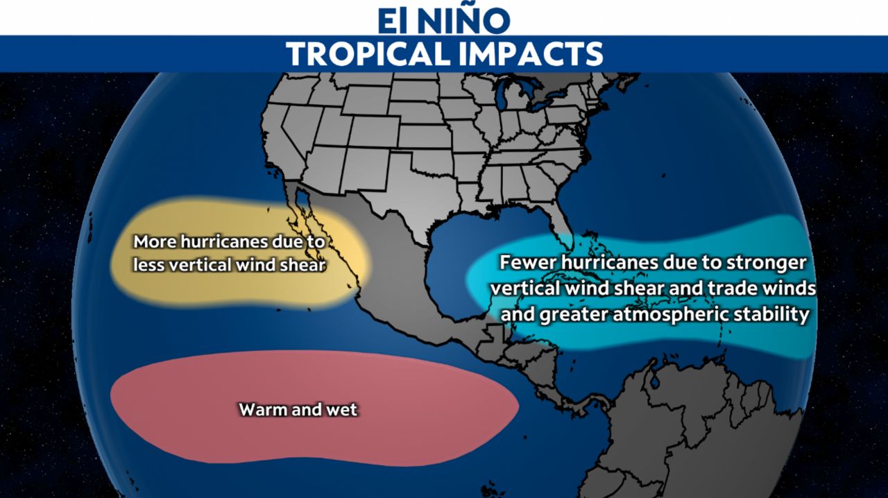
Wind shear, the change of wind speed and/or direction with height, strengthens over the Atlantic and the Caribbean Sea during El Niño. Wind shear helps break a cyclone apart, causing it to weaken.
There are also stronger trade winds and greater atmospheric stability.
This means that there are fewer hurricanes in the Atlantic during El Niño.
Even with a decrease in activity, just one storm can make a hurricane season bad. Always stay prepared.
Conversely, the Pacific sees more hurricane activity because of less vertical wind shear and warm and wet conditions.
How El Niño has affected weather in the past
Past El Niños have brought a mixture of record rainfall and tropical storms to quiet Atlantic tropical seasons. Let’s look at some of the strongest El Niños in the past 40 years.
The 1982-1983 El Niño reduced the number of storms in the Atlantic during the 1982 and 1983 tropical season. Combined, there were only 17 named tropical storms and hurricanes. The U.S. also saw unusually warm temperatures all winter, with many records broken.
The 1997-1998 El Niño brought the second most powerful hurricane in the eastern Pacific during the 1997 season. Hurricane Linda was a category 5 hurricane with sustained winds of 185 mph and a pressure reading of 902 mb. Both the wind and pressure readings were records until Hurricane Patricia in 2015.
In the U.S., California saw record rainfalls during its 1997-1998 wet season, with Santa Barbara getting 21.74 inches of rain in February alone. The city of Fort Bragg saw a record-breaking season with 79.13 inches of rain.
Another strong El Niño occurred from 2014-2016, leading to a record-breaking 2015 tropical season in the eastern Pacific. There were 26 named storms, with 16 becoming hurricanes and 11 becoming major hurricanes.
In the southeastern and south central U.S., we had above normal rainfall in 2015. Missouri had its wettest December on record with 11.74 inches, knocking the old record of 7.82 inches in 1982 out of the park.