Get ready for storms packing an attitude in Central Florida. We’re set to track storms, potentially bringing us torrential rain, wind gusts over 50 mph, and hail up to one-inch in diameter.
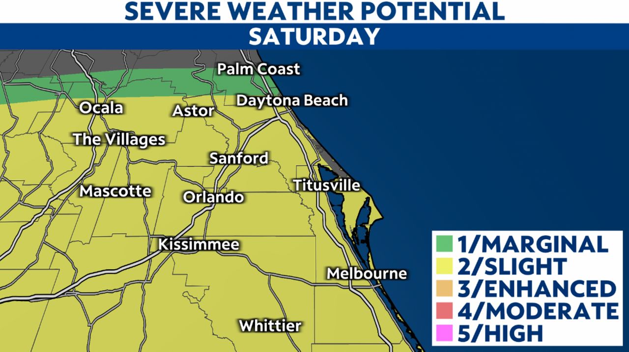
Parts of Central Florida are under a slight risk (level 2/5) of severe weather Saturday afternoon and evening. We will monitor storm development along the east coast sea breeze by early afternoon, then turning our attention to widespread storms moving in from the Gulf of Mexico by mid-to-late afternoon into the evening.
The primary threats of the storms will be damaging winds with gust over 50 mph, torrential rain, and up to quarter-sized hail. Although a very low threat, we cannot rule out a pop-up tornado.
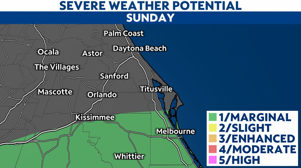
We’ll enjoy more sunshine on Sunday with a few hit-and-miss showers and storms.
A marginal risk of severe weather (level 1/5) is currently in place south of Orlando. Any isolated thunderstorms developing in the afternoon may produce strong winds, lightning, and hail.
We encourage anyone who has plans this weekend to stick with us for updates. Sign up for weather notifications to keep tabs on the storm.