As long as meteorologists have tracked tornadoes, scientists and researchers have looked for ways to better forecast these destructive forces of nature.
Right now, a large storm field campaign is underway to study the impact of tornadoes that spawn from a line of thunderstorms. The hope of the researcher is to use that data to give earlier warnings to people in the storm’s path.
Purpose of PERiLS
NOAA’s National Severe Storms Laboratory (NSSL) calls it the PERiLS project. PERiLS stands for Propagation, Evolution and Rotation in Linear Storms. The first wave of the project began March 1 and wrapped up April 30.
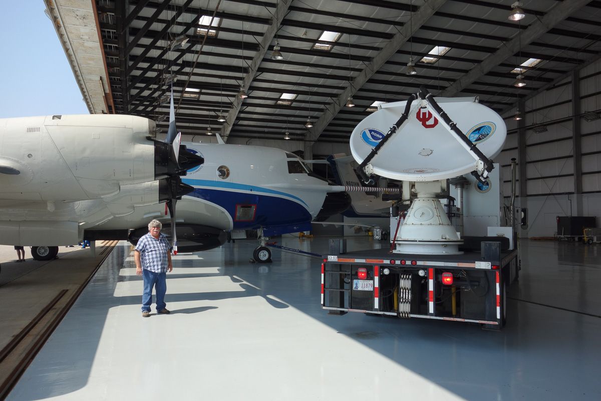
SMART-R Mobile Radar (NSSL)
The purpose of PERiLS is to understand the environments of how QLCS (quasi-linear convective systems) tornadoes form. Tony Lyza was the field coordinator for the project’s first year of data collection in the southeast. He told Spectrum Networks that QLCS tornadoes are usually weak on the Enhanced Fujita Scale (EF 0-EF 1), but not all are.
“I have personally surveyed numerous strong (EF2-EF3) QLCS tornadoes, which can cause major damage even to site-built structures. But even EF0-EF1 tornadoes in the southeast can pose a significant hazard because of the amount of manufactured housing in the region and the population density.”
A focus on the South
The scope of the storm field study will focus on the South. The study ranges to the southeast from the Missouri bootheel southward to the Gulf Coast and from the Mississippi Valley eastward to the foothills of the Appalachian Mountains.
“QLCS tornadoes are common in the South because of the strength of the jet stream disturbances that are associated with severe weather in that region. Given that the severe weather season runs from late winter into the spring, the stronger jet stream waves tend to lead to a lot of thunderstorms developing, which often then merge together to form these QLCSs,” said Lyza.
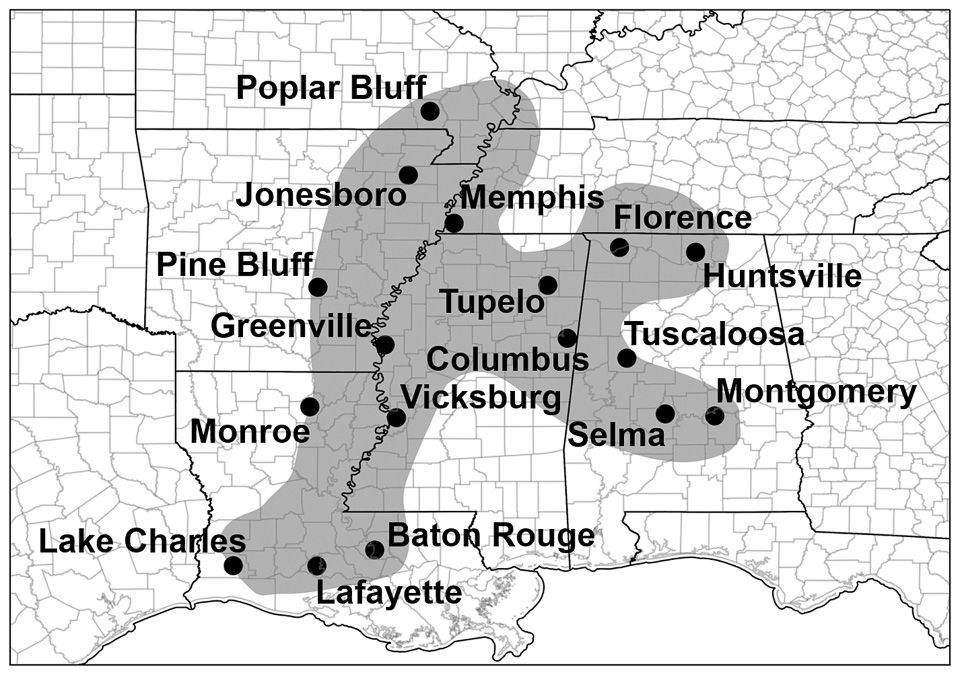
The PERiLS project domain (NSSL)
The NSSL says is also important to highlight this region because many of the tornadoes occur at night and outside of the traditional Spring tornado season.
“Conducting this study in the southeast is also particularly important given the vulnerability of the population, since it features a much higher population density than many other tornado-prone regions… and there are many socio-economic sources of vulnerability, particularly the amount of population living in manufactured housing.”
First wave of data
PERiLS has a team of at least 75 people and a group of several universities working together to conduct the study. The first wave of the study wrapped up at the end of April.
“We had an extremely successful data collection campaign in Spring 2022, with at least 15 tornadoes occurring within our domains during four operations periods,” Lyza told Spectrum.
Here’s the breakdown of the tornadoes they surveyed.
March 22: 5 tornadoes in east-central Mississippi and west-central Alabama
March 30: 2 tornadoes in northeastern Mississippi
April 5: 5 tornadoes in central Alabama
April 13: 3 tornadoes in northeastern Arkansas, northern West Tennessee, and the Missouri bootheel
Right now, a preliminary analysis is underway over the data they collected. “The process of quality controlling and analyzing the data takes a long time, especially for a dataset of this size. It will be at least a few months until any preliminary data analysis is completed.”
Another study will happen next year from Feb. 8 to May 8 2023. Lyza says the PERiLS project will help improve forecasting of tornadic events and spot where in a line of thunderstorms, a tornado is likely to form.